Cycling the Sheep's Head Peninsula: A 75 km Loop
75 km from Bantry out to Kilcrohane and back through Durrus. Steady climbs rather than steep ones, and far less traffic than neighbouring Beara.
Introduction
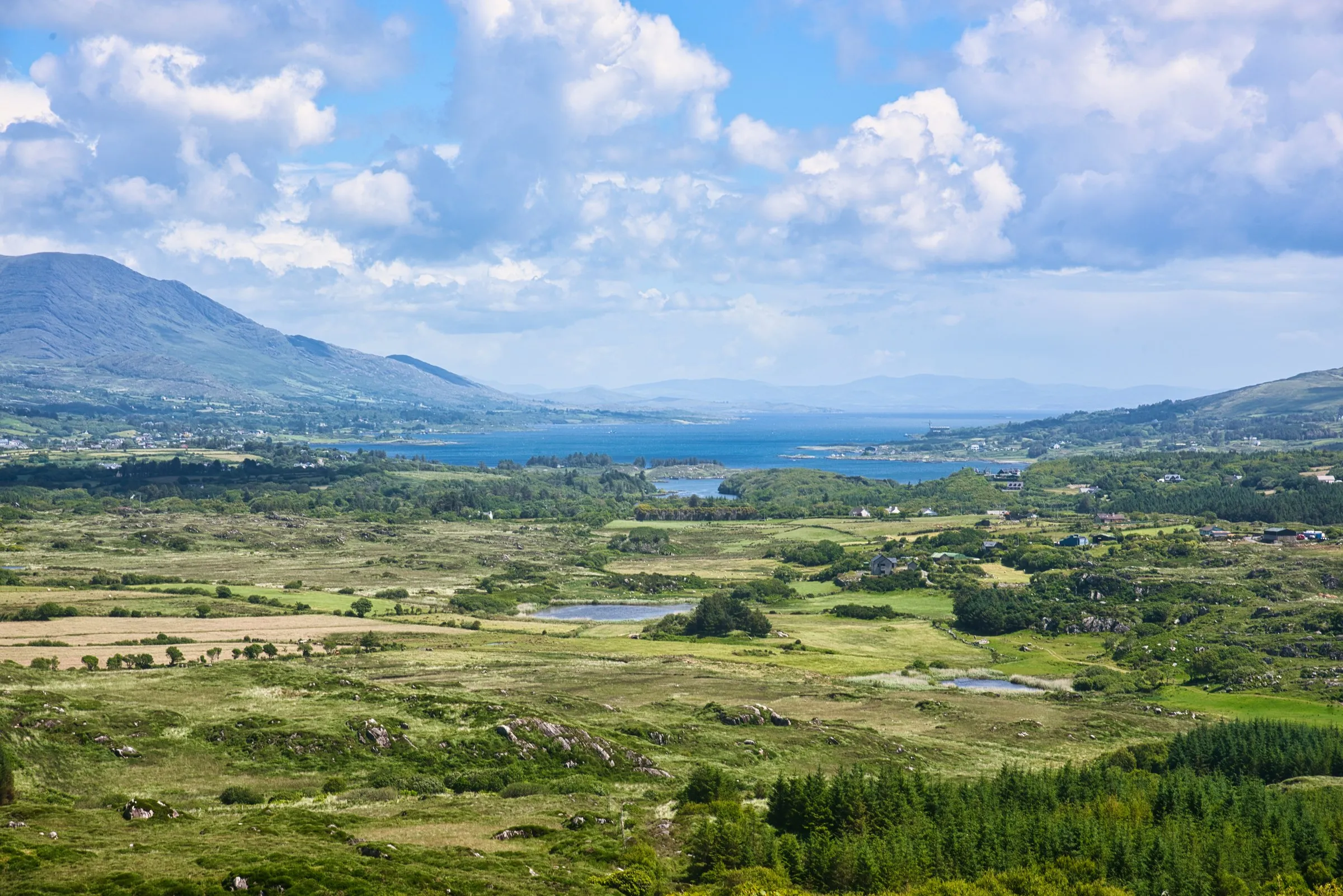
Sheep’s Head is the quiet one. The peninsula runs out between Bantry Bay and Dunmanus Bay in West Cork on narrow roads that carry very little traffic, and the climbing never gets much steeper than five per cent. It does go on all day, though, which is the part people underestimate. The 75 km Sheep’s Head Cycle Route can be ridden as one long day or broken into shorter sections, with cafés at Kilcrohane, Ahakista and Durrus to break up the effort.
Why Choose Sheep’s Head?
| Feature | Detail |
|---|---|
| Distance | 75 km (≈ 47 mi), a full loop that can be ridden in one long day or broken into shorter sections |
| Elevation | Total ascent 1 012 m, descent 1 012 m; highest point 185 m above sea level |
| Difficulty | Moderate, steady climbs, good road surface, low traffic |
| Average speed | 20 km h⁻¹ (≈ 4-hour ride for fit cyclists) |
| Scenery | Sea cliffs, sandy beaches, heathland, historic villages, lighthouse |
| Trail markers | Dedicated Sheep’s Head Cycle Route signs; downloadable GPX/PDF from the official website |
| Wildlife | Choughs, fulmars, peregrine falcons, coastal flora such as Viola lactea and Tuberaria guttata |
The route is part of the larger Sheep’s Head Way network, which includes 20 looped walks and the celebrated 88 km walking trail. A ride combines easily with the short walk out to the Sheep’s Head Lighthouse, or with the ring forts scattered across the headland.
Getting There
By Air
The nearest international airports are Cork Airport (K Cork) (≈ 120 km) and Shannon Airport (K SNN) (≈ 200 km). From either airport, rent a bike-friendly car or join a shuttle service to Bantry.
By Train & Bus
Irish Rail runs a service to Cobh and Mallow; from there, Bus Éireann routes 250 and 251 connect to Bantry (≈ 2 h). The Bantry bus stop is a short walk from the town centre where the cycle route begins.
Parking & Bike Racks
Bantry town offers free on-street parking and a secure bike rack at the Bantry Heritage Centre. For those arriving by car, the Bantry Bay Car Park (off the N71) provides ample space and easy access to the route’s western start at the Goat’s Path.
The 75 km Cycle Route: Section by Section
1. Bantry → Kilcrohane (≈ 22 km)
- Start: Bantry town centre, follow the Goat’s Path westwards.
- Highlights: Panoramic views over Bantry Bay, the historic St. Finbarr’s Church, and the Caher Loop trailhead.
- Climb: Gentle ascent to 120 m before a descent into Kilcrohane.
- Stop: Kilcrohane village, a perfect spot for a coffee at Kilcrohane Café and a short 3 km walk to the lighthouse (the Lighthouse Loop).
2. Kilcrohane → Ahakista (≈ 18 km)
- Route: Continue on the coastal road, passing Tooreen where a small café offers a quick snack.
- Scenery: Rugged cliffs, occasional glimpses of Dunmanus Bay, and the Dooneen Island Loop signpost for a detour.
- Climb: A steady rise to 150 m before descending into Ahakista.
- Stop: Ahakista Harbour, enjoy fresh seafood at Arundel’s by the Pier with views of Kitchen Cove.
3. Ahakista → Durrus (≈ 20 km)
- Route: The road winds inland, crossing the Coomkeen Loop and passing the Brahalish Ringfort.
- Highlights: Open heathland, wildflowers, and possible sightings of choughs perched on the cliffs.
- Climb: A series of short undulations, the highest point of the day at 185 m near Caher Loop.
- Stop: Durrus, the village’s Fish Kitchen serves locally caught oysters and Durrus cheese.
4. Durrus → Bantry (≈ 15 km)
- Route: Follow the Durrus Loop back towards Bantry, with options to explore the Barán Loop or Glanlough Loop for extra mileage.
- Finish: Return to Bantry town centre, where you can park the bike and celebrate with a pint at the Bantry House Café.
Optional Detours:
- Barnageehy Loop (2 km), a quiet road through farmland.
- Funeral Path Loop (4 km), a historic track with interpretive signs.
All loops are clearly signposted, and the main route is marked with a white “S” on a blue background.
Elevation Profile & Difficulty
The total climb of 1 012 m is spread evenly across the loop, meaning there are no steep, sustained gradients, the steepest sections are around 5 %. For most cyclists, the route feels like a series of gentle hills rather than a mountain ride. The moderate grade, combined with the relatively low maximum altitude (185 m), makes the loop suitable for:
- Road bikes with comfortable tyres (32-38 mm) for mixed surfaces.
- Gravel bikes for the occasional rougher farm tracks.
- Hybrid/ touring bikes for those carrying panniers.
A typical fit rider can complete the full loop in 3.5-4 hours at a relaxed pace, allowing plenty of time for stops and photo opportunities.
Best Time to Ride
| Month | Avg. Max Temp (°C) | Avg. Min Temp (°C) | Rainfall (mm) | Visitor Density |
|---|---|---|---|---|
| May-June | 13-16 | 7-9 | 70-90 | Light |
| July-August | 15-18 | 9-11 | 80-110 | Moderate |
| September | 14-16 | 9-10 | 75-95 | Light |
| October-April | 8-13 | 4-7 | 100-150 | Very Light (but wetter) |
Thanks to the Gulf Stream, the peninsula enjoys the mildest Irish climate. July offers the warmest temperatures (average high 15 °C) and the longest daylight (up to 16 h), making it the most popular month for cyclists. The route stays rideable from May to September. Go in early spring or late autumn and you will have the roads more or less to yourself, at the cost of a much higher chance of riding in rain.
Practical Tips for a Smooth Ride
- Bike Choice & Tyres: 32-38 mm road tyres or 35-45 mm gravel tyres provide a balance of speed and comfort on the occasional farm track.
- Navigation: Download the official GPX file from the Sheep’s Head Way website and load it onto a bike-computer or smartphone. A paper map is also available at the Bantry Heritage Centre.
- Weather Gear: Pack a lightweight water-proof jacket, arm warmers, and spare tube. Irish weather can change quickly, especially near the coast.
- Safety: The roads are low-traffic but not completely traffic-free. Wear a high-visibility vest and keep lights on, even in daylight.
- Hydration & Nutrition: Carry at least 1.5 L of water and energy snacks (nuts, fruit). Refill at cafés in Kilcrohane, Ahakista and Durrus.
- Pannier Packing: If you’re doing a multi-day trip, distribute weight evenly and include a light rain-cover for your gear.
- Dog Friendly: Some loop walks allow dogs, but the main cycle route is not recommended for pets due to traffic. Check individual loop signs if you plan to bring a four-legged companion.
Where to Eat & Stay
Food Highlights
- Kilcrohane Café: Homemade soups and scones.
- Arundel’s by the Pier (Ahakista): Fresh fish, mussels, and a table looking out over Kitchen Cove.
- The Fish Kitchen (Bantry): Daily catches, Durrus cheese board, and local craft beers.
- Gouge’s Deli (Durrus): Sandwiches, artisan breads, and vegetarian options.
Accommodation Options
| Type | Location | Approx. Price (per night) | Notes |
|---|---|---|---|
| Bed & Breakfast | Bantry town centre | €90-€120 | Breakfast includes local produce. |
| Self-catering Cottage | Kilcrohane | €110-€150 | Ideal for cyclists; secure bike storage. |
| Boutique Hotel | Durrus (Blairscove House) | €130-€180 | 4.5 acre gardens, on-site laundry. |
| Camping/ Glamping | Near Coomkeen Loop | €30-€55 | Pitch for tents or motorhomes, basic facilities. |
Booking in advance is advisable during the summer months, but shoulder-season availability is generous.
Wildlife & Heritage Highlights
- Lighthouse at Sheep’s Head: A 19th-century beacon offering panoramic vistas; reachable via a 3 km walk from Kilcrohane.
- Ring Forts: Explore Brahalish Ringfort and Caher Loop for a glimpse of Iron Age settlement.
- Birdlife: Spot choughs, fulmars, and occasionally peregrine falcons along the cliffs. Bring binoculars for the best experience.
- Flora: The heathland hosts rare plants such as Viola lactea (pale dog violet) and Tuberaria guttata (spotted rock-rose). Early summer is the best time for wildflower walks.
Sustainable Cycling on Sheep’s Head
The peninsula was awarded European Destination of Excellence for Sustainable Tourism (2009) and continues to promote low-impact travel. To help preserve its tranquillity:
- Stick to marked routes: avoid creating new tracks on fragile heath.
- Carry out all litter: use the Leave No Trace principle.
- Use refill stations: many cafés provide water refill points, reducing plastic waste.
- Support local businesses: buying food and accommodation locally sustains the community.
Conclusion
Sheep’s Head will not test a strong rider the way a mountain route would, and that is not what it is for. The 75 km loop is marked the whole way round with a white “S” on a blue background, so navigation looks after itself and you can spend the day watching the sea rather than the map. Download the GPX from the Sheep’s Head Way site, pack a waterproof, and allow more time than the distance suggests.