Understanding Irish Place Names on Your Cycle
The common elements in Irish place names, how bilingual road signs are laid out, and the tools that will decode a name at the roadside.
Introduction
Irish placenames describe the ground they sit on. Sliabh is a mountain, Áth is a ford, Gleann is a valley. Learn a dozen of these elements and a road sign starts working as a rough terrain profile, telling you what is coming before the map does. Béal Feirste (Belfast) and Cill Chainnigh (Kilkenny) both carry that kind of information, and so do the townlands you pass without stopping.
The elements below are the ones you will meet most often on the Wild Atlantic Way, the Ring of Kerry and the Dublin-Galway Greenway.
1. Why Irish Placenames Matter to Cyclists
| Benefit | How It Helps You on the Bike |
|---|---|
| Navigation clues | Many names describe physical features (e.g., Béal “mouth/approach”, Sliabh “mountain”, Áth “ford”). Spotting a “Sliabh” can warn you of an upcoming climb. |
| Cultural immersion | Knowing that Baile an Chaisleáin means “town of the castle” adds context when you pass a historic ruin. |
| Safety | Names like Áth often indicate a river crossing, useful for checking bridge conditions or flood warnings. |
| Storytelling | Sharing the meaning of Cluain na Siú (“meadow of the fairy”) with fellow riders makes the journey memorable. |
The Placenames Database of Ireland (logainm.ie) records over 61,000 Irish placenames, each with an English version, an Irish version, and an explanatory note. Look up a route the night before and you will have a fair idea of where the climbs and the river crossings are.
2. Decoding Common Elements in Irish Placenames
Below are the most frequently encountered components, their literal translations, and what they signal on the road.
| Irish element | English translation | Typical landscape cue |
|---|---|---|
| Béal / Beal | mouth, approach, ford | Often near river mouths or valleys (e.g., Béal an Átha, “mouth of the ford”). |
| Áth | ford | Indicates a shallow river crossing; historically a key travel route. |
| Cill / Kil | church, cell | Usually marks an old ecclesiastical site; expect a village or ruins. |
| Dún | fort | Hilltop or historic fort; may be a high point or scenic overlook. |
| Gleann / Glen | valley | A descent or a road winding through a valley. |
| Sliabh / Slieve | mountain | Sign of a climb; the higher the number after it, the higher the peak. |
| Rath | ringfort | Often a low hill or ancient settlement. |
| Tír / Tir | land, territory | Broad area, sometimes a county name (e.g., Tír Chonaill, Donegal). |
| Coill | forest | Expect wooded sections or a national forest. |
| Inis | island | May indicate a true island or a peninsula (e.g., Inis Mór). |
| Port / Port | harbour, port | Near a coastal inlet or harbour. |
| Uisce | water | Near a lake or river (e.g., Uisce in Uisceabhán). |
Example: The Wild Atlantic Way
| Segment | Placename | Meaning | What Cyclists See |
|---|---|---|---|
| Mullaghmore, Co. Sligo | Mullach Mór | “big summit” | A steep climb up the coastal headland. |
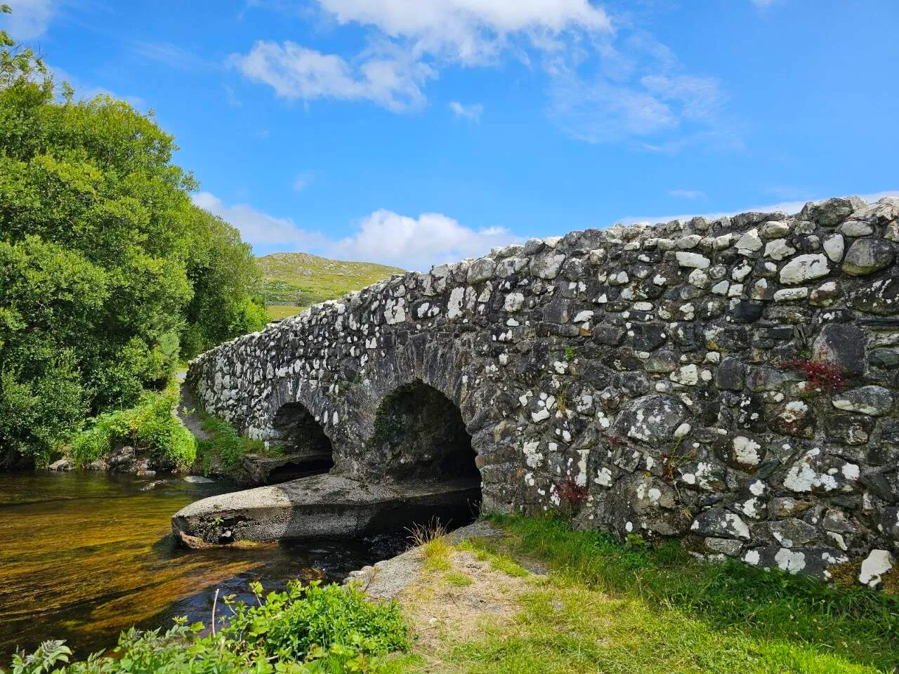
| Clifden, Co. Galway | An Clochán | “the stepping-stone” | A historic stone bridge over the Abhainn an Ghabhal. |
| Dingle Peninsula | Corca Dhuibhne | “the tribe of the black-haired” | Cultural sites linked to the Dingle Gaelic tradition. |
| Bantry Bay | Bun na Trá | “bottom of the strand” | Flat coastal road with strong cross-winds. |
| Cill Rónáin (Killarney) | Cill Rónáin | “church of Rónán” | Near the historic St. Rónán’s church and the Lakes of Killarney. |
3. Bilingual Road Signs: What You’ll See on the Road
3.1 Legal Background
- The Road Traffic (Signs) Regulations 2024 (S.I. No. 200/2024) mandated that all new road signs display both Irish and English, using the Gaelic typeface for the Irish text.
- As of 2024, there are ≈ 19,500 bilingual signs across the Republic, covering motorways, regional roads, and tourist routes (source: Department of Transport press release, April 2025).
3.2 Typical Sign Layout
- Irish text on top (larger, bold Gaelic font).
- English translation underneath (same size).
- Colour coding follows EU standards, blue for motorways, green for primary routes, white for local roads.
- Directional arrows are identical for both languages; only the place name changes.
3.3 Reading Tips for Cyclists
| Situation | What to Look For | Quick Interpretation |
|---|---|---|
| Approaching a town | Baile / Bally on top, English below | “Town of …”, expect services, shops, possible traffic calming. |
| Near a river crossing | Áth on top | Look for a bridge; check for flood warnings. |
| At a mountain pass | Sliabh / Slieve | Prepare for a climb; check gradient on your bike computer. |
| Sign for a tourist trail | Fáilte (welcome) or Rannpháirc (circuit) | Indicates a scenic loop, great for a detour. |
4. Tools to Help You Decode Placenames on the Fly
| Tool | Platform | Key Features |
|---|---|---|
| Logainm.ie Mobile | iOS / Android | Offline Irish placename database; search by English name to reveal Irish form and meaning. |
| Google Maps (Irish layer) | Web / App | Toggle “Irish” language in settings; shows bilingual place names on the map. |
| OpenStreetMap (OSM) Irish Tags | Web | Many Irish names are tagged with name:ga; cyclists can enable custom map styles. |
| Cycling Ireland’s Route Planner | Web | Includes placename glossaries for popular routes (e.g., Ring of Kerry). |
| Audio Guides (e.g., Irish Storytelling Podcast) | Podcast | Provides narrated histories of towns along the Wild Atlantic Way, perfect for long climbs. |
Pro tip: Before a multi-day ride, download the Logainm.ie offline database for the counties you’ll cross. A quick lookup on a rest stop can turn a simple Béal into a story about an ancient ford.
5. Practical Applications on Popular Cycling Routes
5.1 Dublin-Galway Greenway
| Segment | Placename | Meaning | Cyclist Takeaway |
|---|---|---|---|
| Mullingar | An Muileann gCearr | “the left mill” | Expect a historic mill site and a gentle downhill after leaving town. |
| Athlone | Áth Luain | “Luan’s ford” | Bridge over the River Shannon, good spot for a water break. |
| Clonmacnoise | Cluain Mhic Nóis | “Meadow of the sons of Nóis” | Rich archaeological area; consider a short detour to explore the monastic ruins. |
| Ballinasloe | Béal Átha na Sluaighe | “mouth of the ford of the host” | Likely a wide river crossing; check for traffic on the bridge. |
5.2 Ring of Kerry (Cyclist’s Loop)
| Placename | Translation | What it tells you |
|---|---|---|
| Cnoc na Péiste | “Hill of the serpent” | Steep, winding ascent, prepare for a challenge. |
| An Rinn | “The peninsula” | Expect coastal winds; keep an eye on weather. |
| Dún Chaoin | “Fort of the fairies” | Historic fort ruins at the tip; great photo stop. |
| Muckross | “Swampy point” | Low-lying area; watch for damp road surfaces after rain. |
6. Safety and Etiquette When Using Placename Knowledge
- Never rely solely on the name for navigation: always confirm with a GPS device or paper map.
- Respect local signage: many bilingual signs are protected under the Road Traffic (Signs) Regulations 2024; vandalism carries heavy fines.
- Mind the wind: names with Port or Bun often indicate exposed coastal sections where gusts can be strong.
- Share the story: when stopping at a café or B&B, mention the placename’s meaning; locals appreciate the interest and it can lead to insider tips.
7. How to Incorporate Place-Name Stories Into Your Cycling Blog or Tour
- Intro paragraph: Start with the Irish name, translate it, and tie it to the terrain you’ll encounter.
- Photo captions: Include the Irish form and a one-line meaning (“Sliabh na gCloch, “mountain of the stones”).
- Route map: Use a customised OSM layer that shows both English and Irish names.
- Cultural sidebar: Add a short note about any associated legend (e.g., Cluain na Siú, “fairy meadow”).
This gives readers something beyond the route data, and it picks up search terms like “Irish placename meanings” and “bilingual road signs Ireland”.
Conclusion
None of this replaces a map, and it should not be asked to. What it gives you is a second layer of information on signs you are already reading: a Sliabh ahead means the road goes up, an Áth means a river and a bridge, a Bun or a Port means you are about to be exposed to whatever the wind is doing. Since new signs went bilingual, that information is on more and more of what you pass.
Spend a few minutes on logainm.ie or a bilingual map app before a long ride and look up the towns and townlands on your route. It takes about as long as checking the forecast, and it is worth roughly as much.