Cycling the Causeway Coastal Route: 116 km on the Antrim Coast
116 km along the Antrim coast to the Giant's Causeway, ridden in a day or split over two. A shorter 30 km section works better with children.
Introduction
The Causeway Coastal Route is 116 km of road between Belfast, the Giant’s Causeway and Derry, with 1,689 m of climbing in it. That is harder than the number looks, because it arrives in short steep bursts rather than long steady drags. Torr Road averages 11.2 % for a kilometre.
The wind decides your day. It comes off the Atlantic, it strengthens as the morning goes on, and there is nothing between you and it on the clifftop sections. A rider who starts at seven and a rider who starts at ten are not doing the same route.
Overview of the Causeway Coastal Route
| Item | Detail |
|---|---|
| Total length | 116.7 km (≈ 72 mi) |
| Total ascent | 1,689 m (≈ 5,540 ft) |
| Typical ride time | 5–7 hours (full route) or 2–3 hours for popular sections |
| Surface | Predominantly sealed road, occasional paved promenade |
| Difficulty | Moderate, steady climbs, a few steep bursts (e.g., Ballintoy Hill) |
| Best months | Late May, early September (long daylight, milder winds) |
| Key towns | Ballygally, Cushendun, Ballycastle, Ballintoy, Bushmills, Portrush, Portstewart |
The route follows the A2 and A36 coastal roads, punctuated by short inland detours that give access to the most scenic viewpoints. The road is well-signposted for cyclists, and many sections are part of the National Cycle Network (NCN 78), meaning you’ll often see bike-friendly markings and occasional cycle lanes.
Planning Your Ride
1. Route statistics you need to know
- Distance: 116.7 km (average rider ≈ 30 km/h on flats, slower on climbs)
- Elevation gain: 1,689 m, comparable to a medium-length mountain-bike stage.
- Key climbs:
- Ballintoy Hill: 2.27 km at an average 3.5 % gradient, max 6.6 % (63 m gain).
- Torr Road Climb: 0.99 km, average 11.2 % (111 m gain)., Several shorter, punchy climbs (e.g., “Fivey Road West” 15.1 % over 0.70 km).
These figures come from a popular Strava route (116.67 km, 1,689 m ascent) compiled by local rider Guy Pearson.
2. Choosing a bike
| Bike type | Why it works | Considerations |
|---|---|---|
| Road bike | Fast on long stretches, efficient on moderate climbs | Ensure tyres are at least 28 mm for a smoother ride on occasional rough sections. |
| Gravel bike | Wider tyres (35-40 mm) give comfort on the occasional cobbled promenade and improve grip on wet cliffs. | Slightly slower on pure tarmac but more versatile. |
| Hybrid/fitness bike | Comfortable upright position, good for mixed-ability groups. | May struggle on the steepest climbs if under-geared. |
A compact gear set (e.g., 11-32 T cassette) is advisable to keep cadence steady on the tougher gradients.
3. Navigation tools
- Garmin Edge 1030/1050 or Wahoo Elemnt Roam, pre-load the GPX file from the Strava route or the official NCN 78 route.
- Komoot and Ride with GPS both have free “Coastal Route” tours with offline maps, waypoint notes, and elevation charts.
- Paper map: OSNI 1:50 000 (Map 12) is handy for off-road detours or if your battery dies.
4. Timing and daylight
In July, sunrise in County Antrim is around 5:00 am and sunset near 10:00 pm, giving you roughly 14 hours of daylight. Starting early (7:00 am) lets you tackle the biggest climbs before the wind picks up from the Atlantic.
Suggested Itineraries
A. The Whole Route in One Day (116 km)
| Time | Segment | Highlights |
|---|---|---|
| 07:00–09:00 | Ballygally → Cushendun (≈ 40 km) | Clifftop views, Game of Thrones caves, quiet fishing villages. |
| 09:30–11:30 | Cushendun → Ballycastle (via Torr Head) (≈ 28 km) | “Torr Hell” climb (23 % gradients on short sections), dramatic sea arches. |
| 12:00–13:30 | Ballycastle → Portstewart (≈ 38 km) | Dunluce Castle, Whitepark Bay, Giant’s Causeway (free entry for cyclists). |
| 14:00–15:30 | Portstewart → Bushmills (≈ 10 km) | Whiskey tasting at Bushmills Distillery, optional ferry to Rathlin Island. |
| 16:00–17:30 | Bushmills → Belfast (≈ 30 km) | Return via the inland A36, optional stop at the historic town of Coleraine. |
Total ride time: 6–7 hours (including short breaks).
Food stops: Mary McBride’s Pub (Cushendun), The Central Bar (Ballycastle), Bothy Café (Whitepark Bay), Harry’s Shack (Portstewart).
B. Two-Day Leisure Loop
| Day | Route | Approx. km |
|---|---|---|
| Day 1 | Belfast → Ballycastle (via Carrickfergus, Glenarm) | 85 km |
| Day 2 | Ballycastle → Derry (via Giant’s Causeway, Coleraine, Limavady) | 95 km |
Break the journey with overnight stays in Ballycastle (Marine Hotel) and Coleraine (The Old Bank House B&B). Two days of 85 and 95 km with an evening in each town, rather than one long push and no time to look at anything.
C. Family-Friendly Short Ride (30 km)
- Route: Ballygally → Cushendun → Ballycastle (via the coastal road).
- Highlights: Easy gradients, plenty of cafés, and the chance to explore Cushendun and Ballycastle without the steep Torr Head climb. Ideal for children over 12 years or mixed-ability groups.
Highlights Along the Way
| Location | Why it’s worth a stop | Practical tip |
|---|---|---|
| Giant’s Causeway | UNESCO World Heritage site, 40,000 interlocking basalt columns. | Free entry for cyclists; park at the Causeway Visitor Centre (pay-and-display). |
| Dunluce Castle | Ruined medieval castle perched on a cliff edge. | Parking at the Dunluce Car Park (small fee). |
| Ballintoy Harbour | Filming location for Game of Thrones (the Iron Islands). | Grab a coffee at the Bothy Café; watch for tide-timed parking. |
| Torr Head | One of the most dramatic sea-cliffs in Ireland, offering panoramic views of Rathlin Island. | Bring wind-proof clothing, the Atlantic gusts can be strong. |
| Bushmills Distillery | Oldest licensed whiskey distillery in the world. | Book a Cyclist’s Tasting (15 min) in advance. |
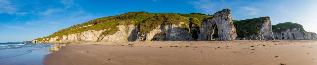
| Whitepark Bay | Unspoiled sandy beach, perfect for a quick dip or a picnic. | The Bothy Café offers pizza and cakes; bike-friendly seating. |
| Portrush & Portstewart | Seaside towns with golden sands, surf schools, and lively pubs. | Use the Portstewart Strand promenade for a flat, traffic-free ride back to the road. |
Practical Tips for a Safe and Enjoyable Ride
1. Weather & Clothing
- Wind is the biggest variable; the Atlantic can produce gusts of 40–50 km/h. Pack a wind-proof jacket and a thermal layer for early mornings.
- Rain is common year-round. Waterproof panniers, fenders, and grippy tyres (28-32 mm) help keep you dry and safe.
- Sun protection: UV can be intense on exposed cliffs; wear a sunscreen and cycling glasses.
2. Bike Maintenance on the Road
- Carry a mini-tool kit (multi-tool, chain-link, spare tube, CO₂ cartridge).
- Lubricate the chain before departure; the salty sea air accelerates wear.
- Check brake pads on the descent from Ballintoy Hill, you’ll need reliable stopping power.
3. Safety & Etiquette
- Wear a helmet at all times (mandatory in NI).
- Use high-visibility clothing and front/back lights, especially in the winter months when daylight is limited.
- Observe speed limits (generally 80 km/h on open road, 50 km/h in villages).
- Respect local traffic; many sections have narrow carriageways with on-coming vehicles.
4. Accommodation & Food
| Town | Recommended stay (bike-friendly) | Food highlight |
|---|---|---|
| Ballygally | Ballygally Castle Hotel (secure bike storage) | The Sea-Salt Café, fresh seafood. |
| Ballycastle | Marine Hotel (bike-racks, sea-view rooms) | Morton’s Fish & Chips, arguably the best in the region. |
| Portstewart | At the Beach guesthouse (direct beach access) | Harry’s Shack, fish, chips, and ice-cream on the deck. |
| Coleraine | The Old Bank House B&B (secure indoor bike storage) | The Kitchen, locally sourced brunch. |
Most places along the coast are used to cyclists and will find somewhere lockable for the bike. Say so when you book. In July and August the rooms with bike storage go first.
5. Navigation & Mobile Connectivity
- 3G/4G coverage is good along most of the coastal road, but there are brief dead zones near Rathlin Island and remote cliffs. Download offline maps.
- Use Strava Heatmaps or Komoot “Surface” filter to avoid any unpaved detours if you prefer sealed roads.
Best Time to Ride
| Season | Pros | Cons |
|---|---|---|
| Late Spring (May-June) | Longer daylight, blooming wildflowers, cooler temperatures (12-16 °C). | Occasional rain showers; some tourist services not fully open. |
| Summer (July-August) | Warm weather (18-22 °C), full range of cafés open, festivals (e.g., Fleadh Cheoil in Derry). | Higher traffic on the A2, especially near tourist hotspots; accommodation fills quickly. |
| Early Autumn (September) | Pleasant temps, fewer crowds, autumn colours on the cliffs. | Shorter daylight (≈ 11 h), occasional early storms. |
| Winter (Oct-Apr) | Near-empty roads, dramatic storm-cloud scenery. | Strong winds, cold (5-10 °C), limited daylight (≤ 8 h). Not recommended for beginners. |
Optimal window: Late May to early September, with a sweet spot in late June to early August for the best balance of weather and services.
Environmental and Cultural Respect
- Leave No Trace: Pack out all litter, especially on beaches and at remote viewpoints.
- Wildlife: You may encounter seabirds (e.g., puffins) on cliffs. Keep a respectful distance and avoid disturbing nesting sites.
- Cultural sites: The Giant’s Causeway and Dunluce Castle are protected heritage sites. Stick to designated paths and parking areas.
- Local communities: Support the economy by buying food and drinks from local pubs, cafés, and B&Bs.
Conclusion
One long day, or two comfortable ones. At 116 km and just under 1,700 m of climbing it is a full day for a confident rider and a long one into a headwind. The two-day split at Ballycastle is the more enjoyable version. The 30 km family section from Ballygally avoids Torr Head altogether, which is the right call with children.
Book beds ahead in summer, carry a windproof whatever the forecast says, and check the brake pads before the Ballintoy descent. The rest is road and weather.