The Connemara Loop: A 93 km Cycling Route
93 km from Maam Cross through Leenaun, Killary Harbour and the Inagh Valley. Exposed, hilly in places, and worth the effort on a clear day.
Introduction
Connemara west of Galway is bog, mountain and coast, and the loop road through it carries little enough traffic that other cars are rarely the problem. The wind is. Roughly 600 m of climbing over the whole circuit, most of it in short pulls rather than long drags, with the steeper work on the Sky Road and around the Twelve Bens. The Connemara Loop (approximately 93 km/58 mi) takes in Killary Harbour, Kylemore Abbey and the Inagh Valley.
Route detail, gear, beds and navigation follow, along with three ways of breaking the loop up if a single day does not suit.
1. The Connemara Loop: Overview & Key Figures
| Item | Details |
|---|---|
| Total distance | ~93 km (58 mi), can be split into shorter loops (34 km Sky Road, 40 km Kilkieran, 60 km Twelve Bens) |
| Elevation gain | Roughly 600 m, gentle climbs with a few steeper sections on the Sky Road and around the Twelve Bens |
| Typical ride time | 4–6 hours (including stops), 1 hour 45 min if driven non-stop |
| Surface | Predominantly paved minor roads, some quiet tarmac and well-maintained country lanes |
| Difficulty | Moderate, suitable for confident road cyclists and strong hybrid riders |
| Best season | Late spring to early autumn (May-September), long daylight, milder weather, fewer rain days |
| Key towns for base | Clifden, Leenane, Maam Cross, Letterfrack, all offer bike hire, B&Bs and cafés |
The loop can be tackled in a single day if you’re fit and eager, but many cyclists prefer to break it into two or three stages, staying overnight in villages such as Leenane or Clifden. Two days also means you can give Kylemore an hour rather than twenty minutes.
2. Detailed Route & Highlights
2.1 Starting Point: Maam Cross (or Clifden)
- Why start here? Maam Cross sits at a historic crossroads 45 minutes northwest of Galway City and offers easy access to the N59 and R336. A small petrol station and several cafés make it a convenient launch pad.
- Alternative start: Clifden, the “Capital of Connemara”, provides more accommodation options and a scenic harbour backdrop.
2.2 The Road to Leenaun (≈ 20 km)
- Scenery: The road threads through a broad valley flanked by Lackavrea and Corcogemore, with heather-sprinkled bogland and grazing sheep.
- Tip: There are pull-outs with views over Loughanillaun. Use them. The road itself is too narrow to stop on safely.
2.3 Leenaun Village & Killary Fjord
- Leenaun: Sits at the head of Killary Harbour, Ireland’s only fjord. Two pubs, a café, and the Killary Wool Museum. That is the village.
- Killary Fjord: A 16 km glacial inlet, deepest at 45 m, home to dolphins, seals and salmon farms. Consider a short boat tour for a different perspective.
- Parking: Free roadside parking near the harbour; the Killary Café is ideal for a coffee break.
2.4 Lough Fee & Renvyle Peninsula
- Lakes & Lakeside Roads: After leaving Leenaun, a right-hand turn leads to Lough Fee, a dark, mirror-like lake framed by steep slopes.
- Beaches: The loop passes three of Connemara’s best beaches within 15 minutes:
- Glassilaun: powdery white sand, turquoise water, parking steps from the shore.
- Lettergesh: long golden stretch, ideal for a quick paddle.
- Renvyle Beach: soft sand with offshore islands, perfect for a picnic.
- Tip: Pack a light lunch; Renvyle House hotel offers a modest café with local produce.
2.5 Kylemore Abbey & Victorian Gardens
- History: Built in 1868, became a Benedictine monastery in 1920. The abbey’s neo-Gothic architecture reflects in Pollacappul Lake, backed by the Twelve Bens.
- What to see: Ground-floor tour, Gothic church, six acres of Victorian walled gardens, woodland walks.
- Time needed: 1.5–2 hours.
- Practical: Admission €6 (adult), €3 (child). Bike racks are available near the car park.
2.6 Inagh Valley & Lough Inagh
- Scenic drive: Turn onto the R344, entering a glacial corridor framed by the Twelve Bens (west) and Maumturks (east).
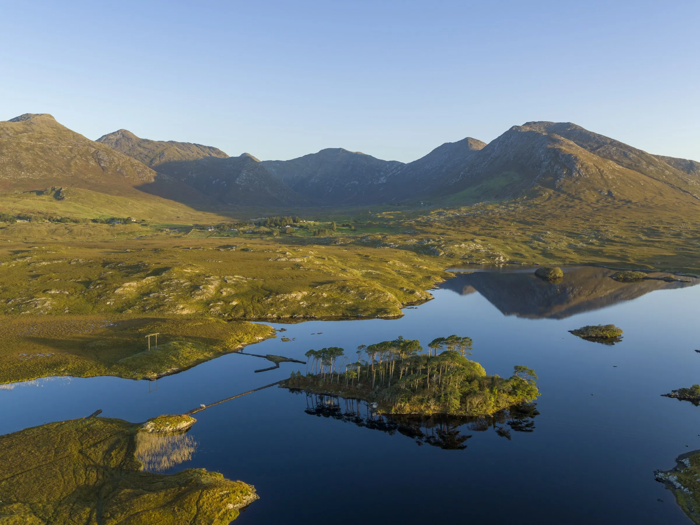
- Lough Inagh: Still water with the surrounding peaks reflected in it on a calm day, which is not every day.
- Pull-in: Small lay-by with benches; ideal for a short snack.
2.7 Derryclare Nature Reserve & Twelve Pines Viewpoint
- Nature Reserve: 19-hectare native woodland at the foot of the Twelve Bens. Offers gentle walking trails if you want to stretch your legs.
- Twelve Pines Viewpoint: Rows of Scots pines against Derryclare Lough, one of Galway’s most photographed scenes.
- Final leg: Re-join the N59 and head back to Maam Cross (or Clifden) to close the loop.
3. Practical Planning Advice
3.1 Bike Choice & Gear
| Bike type | Suitability |
|---|---|
| Road bike | Fast on tarmac; ensure you have a sturdy tyre (28-32 mm) for occasional rough sections. |
| Hybrid / Gravel bike | Ideal for mixed surfaces; wider tyres (35-40 mm) provide comfort on uneven stretches. |
| Electric assist (e-bike) | Great for tackling the modest climbs without excessive fatigue, especially on longer multi-day trips. |
Essential gear: helmet, gloves, waterproof jacket, spare inner-tube, pump, multi-tool, and a bike lock (many villages have secure bike racks). A small day-pack with water, energy bars, sunscreen and a map/app is advisable.
3.2 Navigation
- Offline maps: Download the route onto Komoot, Ride with GPS, or Google Maps offline. The Irish Road Trip provides a ready-made GPX file.
- Physical map: The Ordnance Survey Ireland (OSI) 1:50 000 map covers the area and is handy for spot-checking.
- Signage: The loop is generally well-signed, but a few turns (e.g., the right turn after Leenaun) are easy to miss. Keep your device or map in view.
3.3 Accommodation & Food
| Village | Recommended stays | Food highlights |
|---|---|---|
| Clifden | The Pier House, Clifden Bay Hotel | Seafood chowder at O’Grady’s |
| Leenaun | Killary Hotel, Leenaun Lodge | Café Killary Café (sandwiches, soups) |
| Letterfrack | Kylemore Guesthouse | Local goat cheese and fresh bakery items |
| Renvyle | Renvyle House Hotel | Fine dining with Connemara lamb |
Most B&Bs welcome cyclists and can store bikes securely. Booking ahead for the high season (July-August) is recommended.
3.4 Weather & Safety
- Weather: Connemara’s Atlantic climate can change quickly. Expect wind, occasional rain, and cooler temperatures even in summer (average highs 16-18 °C). Pack layers.
- Safety: Roads are narrow but have low traffic volumes. Stay visible (bright clothing, rear lights) and respect local farmers and livestock.
- Emergency services: The nearest ambulance station is in Clifden; call 112/999 for emergencies.
3.5 Environmental Respect
- Stick to designated pull-ins and car parks; avoid parking on private farmland.
- Take litter with you; many sites have limited bins.
- Respect wildlife, especially around Killary Fjord where seals and birds are common.
4. Sample Itineraries
4.1 One-Day Full Loop
| Time | Activity |
|---|---|
| 08:00 | Depart Maam Cross, coffee & fuel stop |
| 09:30 | Arrive Leenaun, explore village, optional boat tour |
| 11:00 | Lough Fee & Renvyle beaches, quick dip or photo stop |
| 13:00 | Lunch at Renvyle House café |
| 14:30 | Kylemore Abbey, guided tour |
| 16:30 | Inagh Valley & Lough Inagh, rest stop |
| 18:00 | Derryclare viewpoint, sunset photos |
| 19:30 | Return to Maam Cross, dinner in local pub |
4.2 Two-Day Adventure (Leenane Base)
Day 1: Maam Cross → Leenaun → Renvyle → Kylemore (≈ 55 km)
Day 2: Kylemore → Inagh Valley → Derryclare → Maam Cross (≈ 38 km)
Stay overnight in Leenaun (Killary Hotel) or Kylemore (Guesthouse). This split reduces daily mileage, allows a relaxed pace, and gives extra time to explore the beaches and the abbey.
4.3 Family-Friendly Loop (34 km Sky Road)
- Start in Ballyconneely, follow the Sky Road (climb to 400 m for panoramic views), descend to Roundstone, and finish back at Ballyconneely. Traffic is light and there are places to stop and eat along the way, which makes it the easiest of the three to do with children.
5. Why Ride It
- Diverse landscapes: from fjords and lakes to sandy beaches and mountain passes, you never see the same view twice.
- Cultural richness: historic villages, Kylemore Abbey, and the traditional Irish music scene add depth to the ride.
- Accessible logistics: multiple bike-hire outlets, B&Bs that welcome cyclists, and clear road signage make planning straightforward.
- Road surface: the loop is a recognised segment of the Wild Atlantic Way, so the tarmac is kept in reasonable order.
- Flexibility: break the loop into shorter loops, add extra detours (e.g., Inishbofin ferry from Cleggan) or extend into Galway City for a longer adventure.
Conclusion
The distance and the climbing are both within reach of anyone who rides regularly, and the climbs are short. Weather is the variable. It can turn inside an hour out here, and there is not much shelter between villages.
Download the GPX before you leave, book beds well ahead in July and August, and carry a waterproof even when the morning looks settled. After that it is just a matter of riding it.