Cycling Donegal's Coastline on the Wild Atlantic Way
Donegal holds 1,134 km of Wild Atlantic Way coastline. How to break it into rideable sections, plus Slieve League, Glenveagh and where to sleep.
Introduction
County Donegal has the longest coastline of any Irish county, 1,134 km (705 mi) of cliffs, beaches and windswept bays. Much of it is served by quiet regional roads and dedicated greenway, which is the real reason to ride here. The Wild Atlantic Way (WAW) route described below runs from the Slieve League cliffs to the remote Gweedore peninsula, with notes on gear, accommodation, weather and safety along the way.
Why Cycle Donegal’s Coastline?
| Feature | Details |
|---|---|
| Coastline length | 1,134 km, the longest of any Irish county (source: Irish County Coastline Study, 1999) |
| EuroVelo 1 link | Donegal’s 255 km route forms part of the trans-national EuroVelo 1 “Atlantic Coast Route” and the Atlantic On Bike project (EU-funded €4.5 m) |
| Landscape variety | Sea cliffs (Slieve League), sandy dunes (Mackoght), peat-blanketed hills (Bluestack), and island vistas (Leitir McArd) |
| Cultural stops | Gaeltacht villages, historic forts (Grianán of Aileach), traditional music pubs |
| Low traffic | Many sections are quiet regional roads and dedicated greenways, ideal for touring cyclists |
The county works either as one long trip or as a series of day rides off the same coast road.
Planning Your Route
Overview of the Donegal Coastal Loop
The Donegal Cycling Route (DCR) is divided into 14 numbered sections that together cover ≈255 km. Below is a concise itinerary that follows the coastline from north to south, with suggested daily distances for a comfortable 5-day tour.
| Day | Sections | Approx. Distance | Key Highlights |
|---|---|---|---|
| 1 | 1, Newtowncunningham → Letterkenny | 30 km | River Swilly bridges, Letterkenny town centre |
| 2 | 2, Letterkenny → Milford | 45 km | Inishowen Peninsula, scenic coastal road to Mackoght (the “Big” mountain) |
| 3 | 3, Ramelton → Glen | 40 km | Slieve League cliffs (1,636 ft), Muckross Head lighthouse |
| 4 | 4, Milford → Creeslough | 25 km | Quiet rural roads, views over Lough Swilly |
| 5 | 5, Glen → Dunfanaghy → Gortahork → Crolly → Dungloe | 70 km (split into two half-days) | Glenveagh National Park, Glen village, Gortahork cliffs, Crolly (Crolly-Mackoght loop) |
| 6 | 7, Dunfanaghy → Dunlewey → Burtonport | 30 km | Lough Duane, Dunlewey lake, Buncrana (optional ferry) |
| 7 | 11, Burtonport → Leitir McArd → Ardara | 35 km | Leitir McArd coastal walk, historic Ardara market town |
| 8 | 13, Ardara → Mountcharles → Donegal Town | 35 km | Mountcharles harbour, Donegal Town castle ruins |
Tip: You can shorten the loop by skipping the northern Inishowen sections (1-2) and start at Ramelton (Section 3). Conversely, seasoned riders may add the North West Greenway extension from Derry to Bridgend for an extra 50 km.
Mapping the Route
- GPX files are available from the official Donegal Cycle Route site (download under “Route Images”).
- Google Maps: Search “Donegal Cycle Route” and enable the “Biking” layer for turn-by-turn directions.
- Komoot & Strava: Community-generated tours exist for each section, often with elevation profiles.
Practical Information
Bike Choice
| Bike type | Why it works in Donegal |
|---|---|
| Hybrid / Gravel bike | Handles mixed surfaces, paved roads, occasional gravel tracks, and light off-road sections near Glenveagh. |
| Touring bike | Robust frame, mounting points for panniers, comfortable geometry for long days. |
| Road bike | Fast on the smoother coastal roads; consider wider tyres (28-32 mm) for stability on windy sections. |
Essential gear: helmet, waterproof jacket (Donegal weather is notoriously changeable), layered clothing, puncture-repair kit, spare inner tubes, multi-tool, and a compact pump. A bike lock is advisable for B&Bs that do not provide secure storage.
Accommodation
Donegal offers a range of cyclist-friendly stays:
| Location | Options | Typical price (per night) |
|---|---|---|
| Letterkenny | B&Bs, budget hotels, Donegal Bay Hotel | €70-€120 |
| Ramelton | Guesthouses, Ramelton House (self-catering) | €60-€100 |
| Glenveagh | Glenveagh Lodge (luxury), campsite | €120-€250 |
| Dunfanaghy | Ballyarnett House, hostels | €55-€95 |
| Donegal Town | Porter’s Hotel, The Harbour Hotel | €80-€150 |
Most establishments are happy to store bikes in a locked room or garage. Booking in advance (especially July-August) is strongly recommended, as the summer high-season sees a surge of tourists.
Food & Drink
- Seafood: Try the fresh cod at McIntyre’s Fish Bar (Dunfanaghy) or the lobster roll at The Harbour Bar (Donegal Town).
- Traditional Irish fare: Irish stew, soda bread, and locally brewed craft beers (e.g., Donegal Brewing Co.).
- Supermarkets: Tesco, SuperValu, and local shops are plentiful for stocking pannier snacks and water.
Weather & Safety
| Condition | Guidance |
|---|---|
| Wind | The Atlantic can produce gusts of 30-40 km/h, especially on exposed headlands. Keep a low profile, use a wind-proof jacket, and consider reducing speed on descents. |
| Rain | Expect showers year-round. Waterproof panniers and sealed bags protect clothing and electronics. |
| Fog | Common in early mornings near the coast; use lights and reflective gear. |
| Mobile coverage | 3G/4G is good in towns; patchy in remote stretches. Download offline maps beforehand. |
| Emergency services | Call 999/112. The Donegal County Council website lists nearest Garda stations and ambulance locations. |
Navigation Tips
- Mark key junctions on your GPX (e.g., “Turn left at Slieve League viewpoint”).
- Carry a paper map of the Donegal Cycle Route as a backup.
- Use signage: EuroVelo 1 markers are being installed; look for the white “EV1” signpost.
Highlights Not to Miss
1. Slieve League Cliffs: “The Irish Grand Canyon”
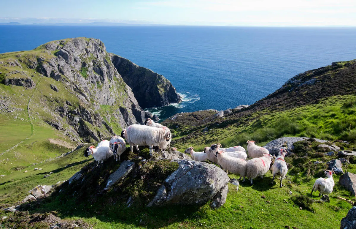
- Height: 1,636 ft (499 m) above the Atlantic, making them the second-highest sea cliffs in Europe after Norway’s Hornelen.
- Viewpoint: The Lookout Platform at Muckross Head offers panoramic vistas; sunrise here is spectacular.
2. Glenveagh National Park
- Landscape: Blanket bog, pine forest, and Lough Veagh.
- Activity: Short off-road detours to the Glenveagh Castle and Lough Veagh Loop (6 km, moderate).
3. Gaeltacht Villages: Ramelton, Gortahork & Ardara
- Culture: Irish-language signage, traditional music sessions in local pubs.
- Food: Sample coddle and barmbrack at family-run cafés.
4. Leitir McArd Coastal Walk
- Length: 5 km (return) with cliff-top paths offering sea-bird spotting (gannets, puffins).
- Access: From Burtonport, a short drive (or bike) to the trailhead.
5. Donegal Town’s Castle and Harbour
- Historic site: 15th-century Donegal Castle overlooks the River Eske.
- Evening: Enjoy a pint of Donegal Irish Whiskey at the harbourside bar.
Sample Day-by-Day Itinerary (5-Day Tour)
Day 1, Arrival & Letterkenny
Fly into Derry/Londonderry Airport (30 km from Letterkenny) or Donegal Airport (Ballyshannon). Pick up a bike from Donegal Bike Hire. Explore Letterkenny’s historic town centre, then ride the gentle River Swilly towpath (10 km) before settling into a B&B.
Day 2, Slieve League Spectacle
Early start from Letterkenny to Ramelton (30 km). Continue to Glen (20 km) and ascend to the Slieve League viewpoint (5 km climb). Descent to Crolly for an overnight stay.
Day 3, Glenveagh & Gortahork
Ride from Crolly to Glenveagh (30 km). Explore the park, then head north to Gortahork (15 km). Sunset at Mackoght (the “Big” mountain) before staying in a local guesthouse.
Day 4, Coastal Loop to Dungloe
Follow the coastal road through Dunfanaghy, Dungloe, and Burtonport (45 km). Optional ferry to Arranmore Island (extra 10 km bike-friendly). Night in Dungloe.
Day 5, Return via Ardara & Donegal Town
Cycle to Ardara (20 km), then Mountcharles (15 km) and finish in Donegal Town (20 km). Celebrate with a dinner of fresh Atlantic seafood before departing.
Adjust distances and rest days to match your fitness level; the total loop is ~255 km, but you can tailor it to 150-200 km for a shorter adventure.
Sustainable Cycling Tourism in Donegal
The Atlantic On Bike project promotes cycling and puts money into local economies:
- Signage: New wayfinding reduces navigation stress and encourages detours to small villages.
- Job creation: Bike-rental shops, guide services, and B&Bs have reported a 15 % rise in bookings since 2022.
- Environmental stewardship: Riders are encouraged to stick to designated paths, carry reusable water bottles, and respect wildlife (especially nesting seabirds on cliffs).
As a visitor, you can contribute by:
- Using local accommodation: supports families and preserves heritage.
- Purchasing Irish-made gear: from Donegal wool cycling caps to handcrafted leather saddles.
- Leaving no trace: pack out all litter, stay on marked trails, and avoid disturbing wildlife.
Frequently Asked Questions
Q: Do I need a special licence to ride on public roads in Donegal?
A: No. A standard Irish or EU driving licence covers you for cycling on public roads. However, a Cyclist’s Insurance policy is recommended for peace of mind.
Q: Is the route suitable for beginners?
A: Some sections (e.g., Letterkenny-Milford) are relatively flat and traffic-free, making them ideal for novices. The more rugged headland climbs (Slieve League, Mackoght) are moderate-to-hard; beginners can opt to bike only the lower-lying parts.
Q: What is the best time of year?
A: Late May to early September offers the longest daylight (up to 17 hours) and milder weather. July-August are busiest; May and September provide quieter roads and still-pleasant temperatures (15-20 °C).
Q: Can I bring my own bike on a ferry?
A: Yes. The Ballycastle-Port of Ballycastle ferry (to Rashenny) accepts bicycles. Check schedules in advance as services are limited in winter.
Conclusion
Donegal is a hard county to ride and an easy one to like. The B&Bs are used to wet cyclists arriving late, and the waymarking is slowly going in. With 255 km to work with, you can ride the whole loop in five days or pick off sections as day trips from Letterkenny or Donegal Town. The route is part of EuroVelo 1 and the EU-funded Atlantic On Bike initiative.
Check the wind forecast before you commit to a direction. On the exposed headlands it will decide how your day goes far more than the gradient does.