Cycling Waterford's Copper Coast: A UNESCO Geopark by Bike
460 million years of geology along one Waterford shoreline. The Stradbally loop, the Kilfarrasy extension and the link to the Waterford Greenway.
Introduction
The Copper Coast is a run of sea cliffs, small coves and abandoned mine workings on the south Waterford shore. Designated a UNESCO Global Geopark in 2015, this 25 km (16 mi) ribbon of coastline records 460 million years of volcanic activity, glaciation and human settlement. For a cyclist that translates into quiet, undulating local roads with the sea on one side, and traffic that only becomes a nuisance in the peak holiday weeks.
The core route is the Stradbally Loop. The climbs on it are short rather than long, but the coast road is exposed, and a headwind on the return leg will cost you more than any of the gradients do.
1. The Geology that Gives the Coast Its Character
1.1 From the Ordovician Sea to Volcanic Islands
- Age: The oldest rocks date to the Ordovician period, ~460 million years ago. At that time the area lay on a continental margin near the South Pole, submerged beneath a deep ocean.
- Volcanic origin: Two submarine volcanoes erupted, depositing mafic rocks (andesite and basalt) that now form the dark, cliff-forming Bunmahon Formation.
- Felsic eruption: Around 455 Mya a second, more explosive volcano produced rhyolitic and breccia rocks, creating the lighter-coloured outcrops seen inland.
1.2 From Sea to Desert: The Devonian Transition
When the land rose above sea level during the Devonian (≈390 Mya), a dry, desert-like environment prevailed. Periodic floods laid down red sandstones, conglomerates and siltstones, giving the coastal cliffs their distinctive rusty hues.
1.3 The Ice Age Sculptors
- Glacial advance: Around 2 million years ago the Irish Ice Sheet covered the region. As the ice moved, it ground the underlying bedrock, carving deep valleys and fjord-like inlets.
- Glacial till: When the ice melted (~12 000 years ago) it left a blanket of boulder-rich clays and tills that now cap many of the cliffs and form the fertile soils of the low-lying valleys.
1.4 Why UNESCO Recognised It
The Copper Coast is Ireland’s first geopark, recognised for:
| Feature | Significance |
|---|---|
| Stratigraphic diversity | Records from Ordovician volcanism to Quaternary glaciations in a compact 25 km stretch. |
| Geoconservation | Over 30 officially designated GeoSites protect key rock exposures and fossil horizons. |
| Cultural overlay | Neolithic dolmens, Iron Age forts and 19th-century copper mines sit atop the geology, illustrating human-environment interaction. |
Most of it is visible from the saddle: the dark cliffs at the coast, the red hills inland, the boulder clay sitting on top of the road cuttings.
2. Cycling the Copper Coast: Routes, Highlights and Difficulty
2.1 Stradbally Copper Coast Loop (The Core Route)
- Length: ~30 km (including a short inland detour to the River Tay woodlands).
- Profile: Mostly gentle undulations with a few short climbs; low gears recommended.
- Surface: Paved local roads; traffic is generally light but can increase during peak holiday weeks.
- Difficulty: Moderate, suitable for riders with a medium level of fitness and basic road-riding experience.
- Key sights:
- Stradbally Village: historic thatched cottages and a small harbour.
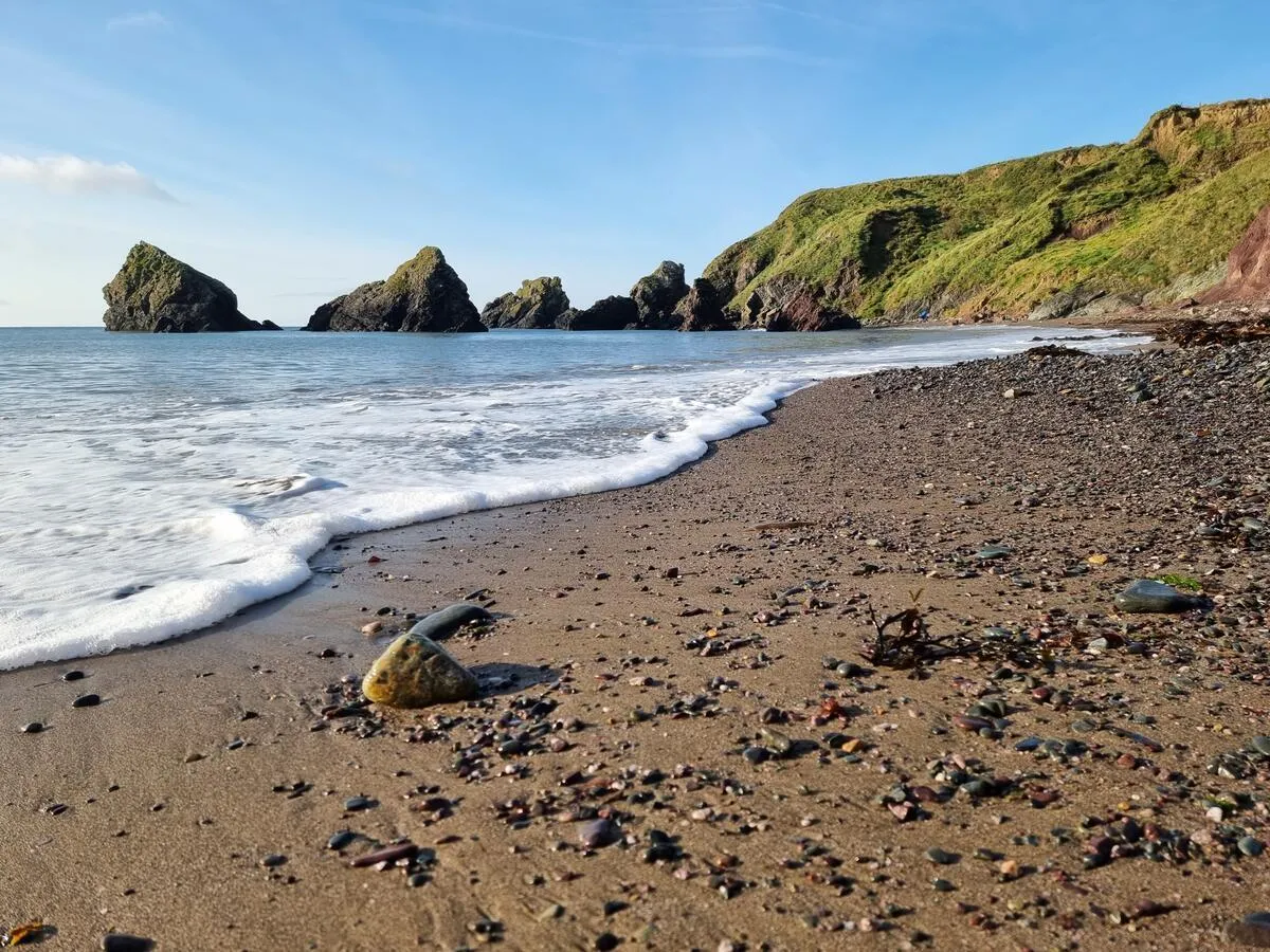
- Stradbally Beach: a secluded cove framed by basalt cliffs.
- River Tay woodlands: a tranquil ride through mixed oak-ash forest.
- Dungarvan Valley outlooks: panoramic views of the Comeragh Mountains and the Atlantic.
Tip: Start early (7–8 am) in summer to avoid the occasional tourist bus that uses the same road to access the beach.
2.2 Extended Coastal Ride: Kilfarrasy to Stradbally
For cyclists seeking a longer challenge (≈45 km round-trip):
- Begin at Kilfarrasy (east end of the geopark) and follow the R683 coastal road past the historic Monksland Church visitor centre.
- Pass the old copper-mine engine house at Kilfarrasy, a reminder of the 19th-century mining boom.
- Continue west to the Moll’s Gap, a steep, short climb offering sweeping sea views.
- Loop back via the inland road through the Ballynarrid Fort area, a well-preserved Iron Age ringfort perched on a ridge.
Elevation gain: Approx. 380 m total, with the steepest section (Moll’s Gap) at a 7% gradient.
2.3 The Greenway Connection
The Waterford Greenway (a 46 km off-road trail from Waterford City to Dungarvan) intersects the western edge of the Copper Coast at Mullane. It is not a road, so it makes a traffic-free way in for families, or for anyone who would rather warm up off-road before joining the Stradbally Loop.
2.4 Route Resources
- Official Cycle Tour Maps: Available for free download from the Copper Coast Geopark website (section “Cycle Tour Maps”).
- GPS files: GPX tracks for the Stradbally Loop and extended coastal ride can be imported into most bike-computer apps (Strava, Komoot, Ride with GPS).
- Signage: Way-marking is modest; a small blue “Geopark” sign appears at key junctions, so a printed or digital map is advisable.
3. Practical Cycling Information
| Aspect | Details |
|---|---|
| Best time to ride | Late May, early September. Average temperatures 14-20 °C, daylight > 15 h, and the sea breeze is gentle. |
| Weather considerations | The Atlantic can bring sudden rain; pack a waterproof jacket and quick-dry layers. Wind can be stronger on exposed headlands. |
| Gear checklist | Helmet (mandatory), well-maintained bike with multiple gears, spare inner tube, pump, multi-tool, water bottle, high-energy snacks, mobile phone with offline map, and a small rucksack for layers. |
| Safety | Roads are narrow and occasionally shared with agricultural vehicles. Use clear hand signals, keep to the left, and wear reflective clothing in low light. |
| Accommodation | • Stradbally Village B&Bs, cosy rooms within walking distance of the loop start. • Dungarvan Harbour Hotel, offers secure bike storage. • Camping, designated sites at Kilfarrasy and Mullane (first-come, first-served). |
| Food & Drink | The Copper Coast Café (Knockmahon) serves hearty Irish fare and offers a cyclists’ menu with sandwiches, soup, and locally brewed tea. Picnic spots are plentiful at Stradbally Beach and Ballynarrid Fort. |
| Bike rentals | Several local shops in Dungarvan and Waterford rent road, hybrid and e-bikes. e-bike hire is popular for tackling the modest climbs without compromising enjoyment. |
| Parking | Free roadside parking is available at Stradbally village car park (capacity 30 cars) and at the Kilfarrasy visitor centre. Arrive early in summer to secure a spot. |
| Accessibility | The Stradbally Loop is largely on paved roads, but some side tracks leading to GeoSites have uneven surfaces; these are not suitable for road bikes with narrow tyres. |
4. Geology-Inspired Stops Along the Ride
4.1 Bunmahon Formation Outcrops
At Bunmahon, you’ll see striking basalt cliffs that illustrate the early mafic volcanic phase. Look for columnar jointing, natural hexagonal pillars formed as lava cooled slowly.
4.2 Tramore Limestone & Trilobite Fossils
A short detour inland near Tramore (outside the core loop but reachable via a side road) reveals calcareous mudstones containing a unique Trilobite species, a reminder of the marine life that thrived when the sea was calm.
4.3 Red Sandstone Ridges
The Devonian red sandstones dominate the inland hills between Stradbally and Kilfarrasy. Their iron-oxide tint gives the hills a warm colour, strongest in the last hour of light.
4.4 Glacial Till Landscapes
The boulder-rich tills that cap many of the cliffs are visible on the road just before the Moll’s Gap climb. Notice the mixed sizes of rocks, from pea-sized pebbles to granite boulders, all deposited by the retreating ice sheet.
4.5 Cultural Heritage Sites
- Ballynarrid Fort: an Iron Age ringfort perched on a ridge, offering panoramic views and a glimpse of early settlement patterns.
- Monksland Church Visitor Centre: housed in a 12th-century ecclesiastical building, it interprets both the geological and cultural history of the area.
Each stop takes 5-15 minutes. Long enough to get your breath back, not long enough to stiffen up.
5. Sustainable Cycling and Community Support
The Copper Coast Geopark operates as a charitable trust that relies on volunteers, local guides and community employment schemes (Solas, Tus). Riders can contribute by:
- Staying in local accommodation: supports the rural economy.
- Purchasing locally produced food: such as Waterford cheese, seafood, and artisanal breads.
- Using the official GPX files: reduces the need for printed maps and helps the trust track visitor numbers for conservation planning.
- Participating in clean-up events: occasional “Bike & Beach” volunteer days are organised in summer; sign-up details are posted on the Geopark website.
The trust runs on volunteers and community employment schemes, so where you spend locally makes more difference here than it does in most places.
Conclusion
The Copper Coast rewards a slow ride. Dark basalt at Bunmahon, red Devonian sandstone in the hills inland, glacial till capping the cliffs. The Stradbally Loop takes in most of it at a moderate effort, and the villages and cafés along the way are used to cyclists turning up wet.
Way-marking is thin, so carry the GPX file or a printed map. Check the wind before you set off, and expect the beach roads to be busier on summer weekends. Nothing here is remote, but the exposed sections feel it when the weather turns.