Five Cycling Day Trips from Dublin
Five rides out of the city, from a 25 km lap of Howth to an 80 km run through the Boyne Valley. Distances, train links and what to stop for.
Introduction
You can be out of Dublin and on a cliff road, a canal towpath or a mountain pass within the hour. The city sits between the sea and the Wicklow uplands, with a suburban rail line running north and south along the coast, so most of the good riding is reachable without a car.
Five routes below, north and south of the city. For each one:
- Approximate distance and elevation gain
- Difficulty level and surface type
- Key attractions and photo-ops
- Practical tips on parking, bike hire, public transport links and where to stop for food or a pint
They run from 25 km on the Howth loop to 80 km if you ride out to the Boyne Valley and back.
1. Howth Peninsula: Coastal Views in 25 km
Overview
| Item | Details |
|---|---|
| Distance | 24.6 km (round-trip) |
| Ascent | 77 m total gain |
| Surface | 100 % paved (asphalt) |
| Difficulty | Easy-moderate, mostly flat with short climbs |
| Time | 2–3 hrs (including stops) |
Why Ride It?
There is 77 m of climbing in the whole loop, so this ride is about exposure rather than effort. Starting at Howth Harbour, you follow the coastal road to the lighthouse, then head inland via the Malahide-to-Portmarnock stretch before looping back through Balgriffin and Coolock to Fairview. The suburban run at the end is the dull part. There is no way round it.
Highlights
- Howth Harbour & Lighthouse: Snap sunrise or sunset over Dublin Bay.
- Malahide Castle & Gardens: Free entry to the grounds; perfect for a picnic.
- Cliff-top vistas: The stretch between Howth and Portmarnock offers panoramic sea views and occasional dolphin sightings.
- Historic villages: Stop for a coffee in the fishing village of Portmarnock or a traditional fish-and-chips shop in Howth.
Practical Tips
- Parking: Free car parks at Howth Harbour (capacity limited on weekends) and at Malahide Castle.
- Bike hire: Dublin Bike (city-wide dock-less) has stations near Fairview and Howth. For road bikes, look to Cycle Hire Dublin (Dublin City Centre) and take a short DART ride to Howth.
- Public transport: DART stations at Howth, Portmarnock and Malahide make the loop accessible without a car.
- Safety: The coastal road can be windy; keep a light rain-jacket handy and wear reflective clothing in low light.
2. Bray to Greystones: The Seaside Rail Trail (≈ 26 km round)
Overview
| Item | Details |
|---|---|
| Distance | 13 km one-way, 26 km round-trip |
| Ascent | 120 m total gain (mostly gentle) |
| Surface | Paved cycle-track and quiet side-streets |
| Difficulty | Easy, suitable for families |
| Time | 2–3 hrs (incl. coffee break) |
Why Ride It?
The Bray-Greystones stretch follows the historic Dublin-Wicklow railway line that closed in 1958 and has been transformed into a traffic-free greenway. The route hugs the Irish Sea, passes sandy beaches and offers a glimpse of the Marlay Park forests.
Highlights
- Bray Seafront: Start with a stroll along the Bray promenade and Bray Pier.
- Marlay Park: A short detour into the park’s woodland trails rewards you with shade and a small lake.
- Greystones Harbour: Finish (or turn back) at this award-winning harbour, where you can refuel at The Harbour Bar for fresh seafood.
- Scenic viewpoints: Lookouts at The Blackrock and Mullaghcarn give sweeping sea panoramas.
Practical Tips
- Parking: Free on-street parking in Bray town centre and a large car park at Greystones Harbour (pay-and-display).
- Bike hire: Bike4U (Bray) and Greystones Cycles offer road and hybrid bikes; you can also bring your own bike on the DART (first-class ticket not required).
- Public transport: DART stations at Bray and Greystones, ride one way and cycle back, or vice-versa.
- Amenities: Several cafés along the route (e.g., The Wave Café in Bray) and public toilets at the greenway’s entry points.
3. Royal Canal Greenway: Dublin to Maynooth (≈ 24 km)
Overview
| Item | Details |
|---|---|
| Distance | 24 km (one-way), 48 km round-trip |
| Ascent | 140 m total gain (steady, gentle) |
| Surface | Compact gravel (well-maintained) |
| Difficulty | Moderate, good for hybrid or gravel bikes |
| Time | 3–4 hrs (including stops at historic sites) |
Why Ride It?
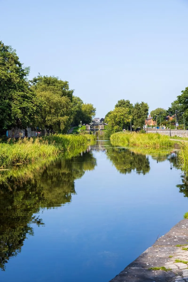
The Royal Canal Greenway is Ireland’s longest off-road cycling route, stretching from Dublin’s Portobello to Longford. The section to Maynooth passes charming towns, riverside towpaths and the historic Royal Canal Aqueduct at Leixlip.
Highlights
- Leixlip Castle & Demesne: 12th-century ruins with a café serving locally sourced treats.
- Maynooth University Campus: A pleasant parkland area perfect for a rest.
- Historic aqueducts & locks: 18th-century canal engineering, best seen at the Leixlip aqueduct.
- Scenic wildlife: Look out for kingfishers, swans and occasional otters along the canal banks.
Practical Tips
- Parking: Secure car parks at Portobello (near the start) and at the Maynooth Town Centre car park (free on-street spaces).
- Bike hire: Bike Ireland in Dublin city centre provides hybrid and gravel bikes; many hire shops in Maynooth also offer rentals for the return leg.
- Public transport: The Dublin Suburban Rail (DART/Commuter) stops at Malahide and Maynooth, allowing you to ride one way and catch a train back.
- Surface note: The gravel is compacted but can be loose after heavy rain; tyre pressure of 80–90 psi works well.
- Facilities: Picnic tables, water fountains and public toilets are spaced roughly every 5 km.
4. Boyne Valley Heritage Ride: Newgrange & Trim (≈ 80 km round)
Overview
| Item | Details |
|---|---|
| Distance | 40 km one-way (Dublin-Newgrange), 80 km round-trip |
| Ascent | 250 m total gain (steady) |
| Surface | Mixed: paved roads, quiet country lanes |
| Difficulty | Moderate-hard, longer distance, some rolling hills |
| Time | 5–6 hrs (incl. sightseeing) |
Why Ride It?
The Boyne Valley holds Newgrange, Knowth, the Megalithic Centre, and the medieval town of Trim with its castle. The route follows the R125 and R132 through rolling farmland. This is the longest of the five and the one most likely to run late, since Newgrange is on timed tickets and you have to fit the ride around them.
Highlights
- Newgrange (Brú na Bóinne): UNESCO World Heritage site; pre-Neolithic passage tomb aligned with the winter solstice.
- Knowth & Dowth: Lesser-known but equally impressive passage tombs.
- Trim Castle: The largest Norman castle in Ireland, featured in Michael Collins (1996).
- River Boyne: Scenic riverside rides and opportunities for a quick paddle or picnic.
Practical Tips
- Parking: Dedicated visitor car parks at Newgrange (pay-and-display) and Trim Castle. Arrive early in summer, spots fill quickly.
- Bike hire: Dublin Bike (city-wide) for the first leg; for the return, Cooley Cycle Hire in Drogheda offers road bikes suitable for longer distances.
- Public transport: DART to Malahide, then a Bus Éireann (route 102) to Newgrange, useful if you prefer a “half-day” ride.
- Entry fees: Newgrange requires a timed ticket (£10 adult, £5 child). Trim Castle entry is £6 adult, £3 child.
- Food: Pack a lunch; the Boyne Heritage Centre Café in Newgrange provides sandwiches and hot drinks.
- Safety: Rural roads may have fast-moving traffic; wear high-visibility clothing and keep a bell for alerting motorists.
5. Wicklow Mountains Loop: Glendalough & Powerscourt (≈ 45 km)
Overview
| Item | Details |
|---|---|
| Distance | 45 km (circuit) |
| Ascent | 600 m total gain (hilly) |
| Surface | Paved roads + well-graded gravel sections |
| Difficulty | Hard, sustained climbs, variable weather |
| Time | 4–5 hrs (plus time for exploration) |
Why Ride It?
Six hundred metres of climbing in a single loop, and the weather up there is not the weather in Dublin. The route takes in the Glendalough monastic site, Powerscourt Waterfall and the Sally Gap road. Hardest of the five by some margin.
Highlights
- Glendalough: Two glacial lakes surrounded by ancient monastic ruins; ideal for a short hike or a coffee at The Bridge Café.
- Powerscourt Waterfall: Ireland’s highest waterfall (121 m), with a well-maintained viewing platform.
- Sally Gap: A classic mountain pass offering panoramic views of the Wicklow uplands, a favourite among cyclists for its challenging climb.
- Lough Dan & Lough Tay: Two lakes below the road, worth stopping for.
Practical Tips
- Parking: Large free car parks at Glendalough (capacity 200) and Powerscourt (pay-and-display).
- Bike hire: Wicklow Cycle Hire in Bray offers road and hybrid bikes; Irish Cycling Tours in Dublin can arrange a full-day rental with a support vehicle.
- Public transport: Take the DART to Bray and a Bus Éireann (route 133) to Glendalough, useful if you want to start the loop from the valley.
- Weather: The mountains can be windy and cooler than Dublin; bring layers, a waterproof jacket and sun protection.
- Fuel & food: The Village of Laragh (mid-loop) has a supermarket and several cafés (e.g., The Wicklow Heather).
- Safety: The Sally Gap climb is steep (average gradient 6–8%); ensure your bike is in good condition, especially brakes and gears.
Conclusion
Which one you pick depends on what you want from the day:
- Howth Peninsula: coastal breeze and historic villages in a short, flat ride.
- Bray-Greystones: a traffic-free seaside greenway ideal for families.
- Royal Canal Greenway: tranquil gravel path through historic towns and waterways.
- Boyne Valley: a heritage-rich journey to ancient tombs and a medieval castle.
- Wicklow Mountains: challenging climbs, waterfalls and monastic ruins for the adventurous rider.
Check the forecast before any of them, and take a rain jacket regardless. Wicklow can be windy and a good deal colder than the city. The other decision worth making in advance is whether you ride both ways or take the train out and pedal back, which halves several of these for the same scenery.