Cycling in County Clare: Loop Head, the Burren and EuroVelo 1
Clare packs road, gravel and EuroVelo 1 riding into one county. West Clare, the Burren and Lough Derg, with maps, hire and the season to aim for.
Introduction
County Clare sits between the Shannon estuary and Galway Bay, and the riding divides into three: the exposed cliff roads of the west, the limestone of the Burren, and the steeper inland lanes above Lough Derg. The wind decides a good deal of it. A coastal loop that rolls along easily in one direction can turn into a slog on the way back, and there is almost no shelter west of Kilkee.
The riding runs from Loop Head to the Burren, plus the 270 km EuroVelo 1 stretch. Transport, bike hire, beds and a set of itineraries follow, along with the reason the county is called the Banner in the first place.
Why Clare Is Known as “The Banner County”
The nickname dates back to the 19th century when political rallies and trade-guild processions filled the streets of Ennis with colourful banners. As Brian O’Dalaigh recorded, local guilds, bakers, butchers, coopers, masons, carried their own flags to greet Daniel O’Connell in 1828 and later to welcome Parnell and de Valera. The tradition of banner-bearing lingered longer in Clare than elsewhere, eventually spilling over into sport, where the county’s hurling and football teams proudly waved the “Banner County” banner.
The name stuck. You will see it on flags at hurling matches, on the sides of vans, and in the name of a 50 km sportive loop at the county cycling festival each June.
Key Cycling Regions in Clare
1. West Clare & Loop Head Peninsula
- Route: Loop Head Peninsula Loop from Kilkee, 42.7 mi (68.7 km)
- Elevation: 1,450 ft (≈ 442 m) of rolling climbs
- Surface: Mostly paved coastal roads, with short gravel sections near the cliffs
- Highlights:
- Panoramic sea views from the Loop Head lighthouse
- Rugged cliffs at the “Cliff of Moy” and the quiet village of Carrigaholt
- Seaside towns Kilkee, Liscannor and Doolin for refreshments
Why ride it? The climbing is spread thin, roughly 442 m across the whole loop, so nothing bites, but the exposure does. It is well signposted, and Kilkee, Carrigaholt and the lighthouse break the ride into rough thirds. Bring food. The gaps between shops are longer than they look.
2. Doolin, the Burren & the Cliffs of Moher
-
Routes:
- Doolin Cycle Hub Loop 3, 25.9 mi (42 km)
- The Burren & Finvarra Loop from Ballyvaughan, 31.9 mi (51 km)
- Cliffs of Moher Loop from Lahinch, 19.7 mi (31.7 km)
-
Elevation: 1,200–1,950 ft (≈ 370–595 m) depending on the loop
-
Surface: Predominantly paved, with short sections of limestone grit on the Burren trails
Highlights:
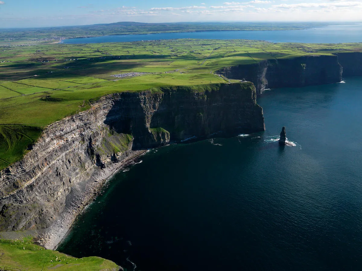
- The Cliffs of Moher, closest on the loop out of Lahinch.
- The limestone karst of the Burren, dotted with ancient tombs and wildflowers.
- Music in Doolin most nights of the week, which is reason enough to finish there rather than start there.
3. Lough Derg & Broadford Loop
- Route: Broadford & Lough Derg Loop from Killaloe, 27.3 mi (44 km)
- Elevation: 1,950 ft (≈ 595 m), the most challenging of the popular loops.
- Surface: Mostly paved; a few gravel stretches near the lake’s shoreline.
Highlights:
- Sweeping lake vistas on Lough Derg, Ireland’s third-largest lake.
- Quiet rural roads that pass historic castles and stone bridges.
4. EuroVelo 1: The Wild Atlantic Way (Clare Section)
- Length in Clare: Approx. 270 km (168 mi) from Loop Head to the Limerick border.
- Designation: Part of the international EuroVelo 1 (Atlantic Coast) network, fully signposted as “EuroVelo 1, Wild Atlantic Way”.
- Surface: A mix of paved roads, quiet secondary routes and occasional off-road sections, ideal for road-bike, hybrid and gravel-bike riders.
Key Waypoints:
- Loop Head Lighthouse (north) → Doolin → Ennistymon → Lahinch → Ennis → Killaloe → Limerick border.
Why it matters: It is the longest continuous signed corridor in the county, and the only route here you can ride for several days without covering the same road twice. B&Bs and hostels sit along most of it, so the stages can be as long or short as you want them.
Practical Planning for a Bike Holiday in Clare
Maps & Navigation
| Tool | Strength |
|---|---|
| Komoot (routes listed above) | Turn-by-turn navigation, elevation profiles, offline maps. |
| Ride with GPS | Detailed GPX files; useful for customising loops. |
| EuroVelo 1 Signage | Green “EV1” signs on the main route; easy to follow. |
| Printed OSI Maps | Handy for off-road detours in the Burren. |
Bike Types & Recommended Gear
| Terrain | Best Bike | Suggested Gear |
|---|---|---|
| Coastal roads (mostly paved) | Road or hybrid bike with thin tyres (25-32 mm) | Lightweight helmet, wind-breaker, water-proof panniers. |
| Burren limestone paths | Gravel bike or cyclocross bike with 35-45 mm tyres | Tire repair kit, mud-guards, sturdy shoes. |
| Hilly inland loops (Lough Derg) | Endurance-road or mountain-bike with gearing for climbs | Lower-handlebar grips, spare chain links, packable rain jacket. |
Getting There & Getting Around
| Mode | Details |
|---|---|
| Air | Shannon Airport (SNN), 30 min drive to Ennis; car-rental or shuttle bus to bike-hire centres. |
| Train | Irish Rail services to Ennis (main hub), connect to Kilkee, Lahinch via Bus Éireann. |
| Bus | Bus Éireann routes 333 (Ennis-Kilkee) and 350 (Ennis-Lahinch) accept bikes on board (subject to space). |
| Car | Ideal for families or those needing to transport multiple bikes; ample parking at most B&Bs. |
Bike Hire & Service
- Doolin Bike Hire: Road, hybrid and gravel bikes; 24 hr pick-up.
- Kilkee Cycle Hire: Small fleet focused on coastal loops; optional guided rides.
- Ennis Bike Shop: Full service, including tyre fitting and bike-repair kits.
Accommodation
| Area | Typical Options | Price Range (per night) |
|---|---|---|
| Ennis | B&Bs, hostels, boutique hotels | €70-€130 |
| Kilkee/Lahinch | Guesthouses, seaside cottages | €80-€150 |
| Ballyvaughan (Burren) | Rural B&Bs, farm stays | €75-€140 |
| Killaloe (Lough Derg) | Lakeside inns, caravan parks | €70-€120 |
Most establishments offer bike-friendly rooms and secure storage. Booking ahead in summer (June-August) is advisable.
Weather & Best Riding Season
Clare’s Atlantic climate is mild but changeable:
| Month | Avg. Temp (°C) | Rainfall (mm) | Ideal for Cycling? |
|---|---|---|---|
| May-September | 12-17 | 70-100 | Peak season, long daylight, warm days. |
| April & October | 9-13 | 80-120 | Good for experienced riders; expect occasional rain. |
| Nov-Mar | 5-9 | 130-180 | Cooler, wetter, suited to strong cyclists with proper gear. |
Tip: Pack layers, a waterproof jacket and always check the wind forecast, Coastal sections can be windy, especially around Loop Head.
Safety & Etiquette
- Road Rules: Ride on the right, signal turns, wear a high-visibility jacket.
- Traffic: Rural roads are narrow; give way to on-coming traffic where visibility is limited.
- Pedestrians: In villages (e.g., Doolin, Ennis) reduce speed and use a bell.
- Wildlife: Keep an eye out for sheep and cattle, especially on the Burren and near Lough Derg.
- Respect Heritage Sites: Do not ride on protected stone forts or archaeological areas; park and walk where required.
Suggested Itineraries
A. One-Day Coastal Loop: “Banner Coast”
- Start/Finish: Kilkee (bike-hire hub)
- Distance: 42.7 mi (68.7 km), Loop Head Peninsula Loop
- Highlights: Loop Head lighthouse, Carrigaholt harbour, the sea cliffs, sunset at Kilkee beach.
- Plan: Early start (07:30 am). Pack a lunch; stop at the Kilkee Café for a sandwich and coffee. Return to Kilkee for a fish-and-chips dinner.
B. Two-Day Burren & Moher Adventure
| Day | Route | Distance | Overnight |
|---|---|---|---|
| 1 | Doolin → Burren Loop (Ballyvaughan) | 31.9 mi (51 km) | Ballyvaughan B&B |
| 2 | Cliffs of Moher Loop (Lahinch) + return to Doolin | 19.7 mi (31.7 km) | Doolin Guesthouse |
Ride the first day through limestone karst, explore the Poulnabrone Dolmen, and enjoy a traditional music session in Doolin on night two.
C. Three-Day EuroVelo 1 Classic
| Day | Segment | Approx. Distance | Key Stops |
|---|---|---|---|
| 1 | Loop Head → Doolin → Ennistymon | 60 km | Doolin, Ennistymon (B&B) |
| 2 | Ennistymon → Lahinch → Ennis | 70 km | Lahinch (surf village), Ennis (historic town) |
| 3 | Ennis → Killaloe → Limerick border | 80 km | Killaloe (Lough Derg), finish at Limerick (train connection) |
Why this works: Each day stays under 80 km, allowing time for sightseeing, meals and a relaxed pace. The route follows the EuroVelo 1 signposts, guaranteeing clear navigation.
D. Week-Long “Banner County Grand Tour”
Day 1-2: Loop Head Peninsula (2 days, 70 km each), explore coastal villages.
Day 3-4: Burren & Cliffs of Moher (2 days, 55 km each), include a guided cave tour at Aillwee.
Day 5: Lough Derg Loop (44 km), enjoy lakeside cafés.
Day 6-7: EuroVelo 1 stretch Ennis-Killaloe (80 km), finish with a cultural night in Ennis.
Accommodation: Mix of B&Bs and a lakeside hostel at Lough Derg for variety.
Total mileage: Approx. 380 km over the week.
Cycling Events in Clare
| Event | When | Description |
|---|---|---|
| Clare Cycling Festival | Early June | Road races, family rides, and a “Banner County Challenge” 50 km loop. |
| Burren Bike Trail Day | Late August | Guided rides through the karst landscape, with talks on geology. |
| EuroVelo 1 Ride-Along | September (varies) | Organized groups ride sections of the EuroVelo 1, ending with a communal dinner in Ennis. |
These are the easiest way to ride the county in company rather than alone, and the guided Burren day is worth it for the geology talk if nothing else.
Conclusion
Clare packs a lot into a small county. From the cliff roads at Loop Head, through the limestone of the Burren, to the lake shore at Lough Derg and the EuroVelo 1 corridor, there is enough to fill a week without repeating a road.
Book beds ahead between June and August, check the wind forecast the night before rather than the morning of, and stay off the stone forts. That covers most of it.