
Cycling the Mourne Mountains: Routes and Climbs
The Mourne Loop and the Spelga Dam climb, plus the coastal route, the Newry Canal Way and forest trails. Getting there and where to refuel.
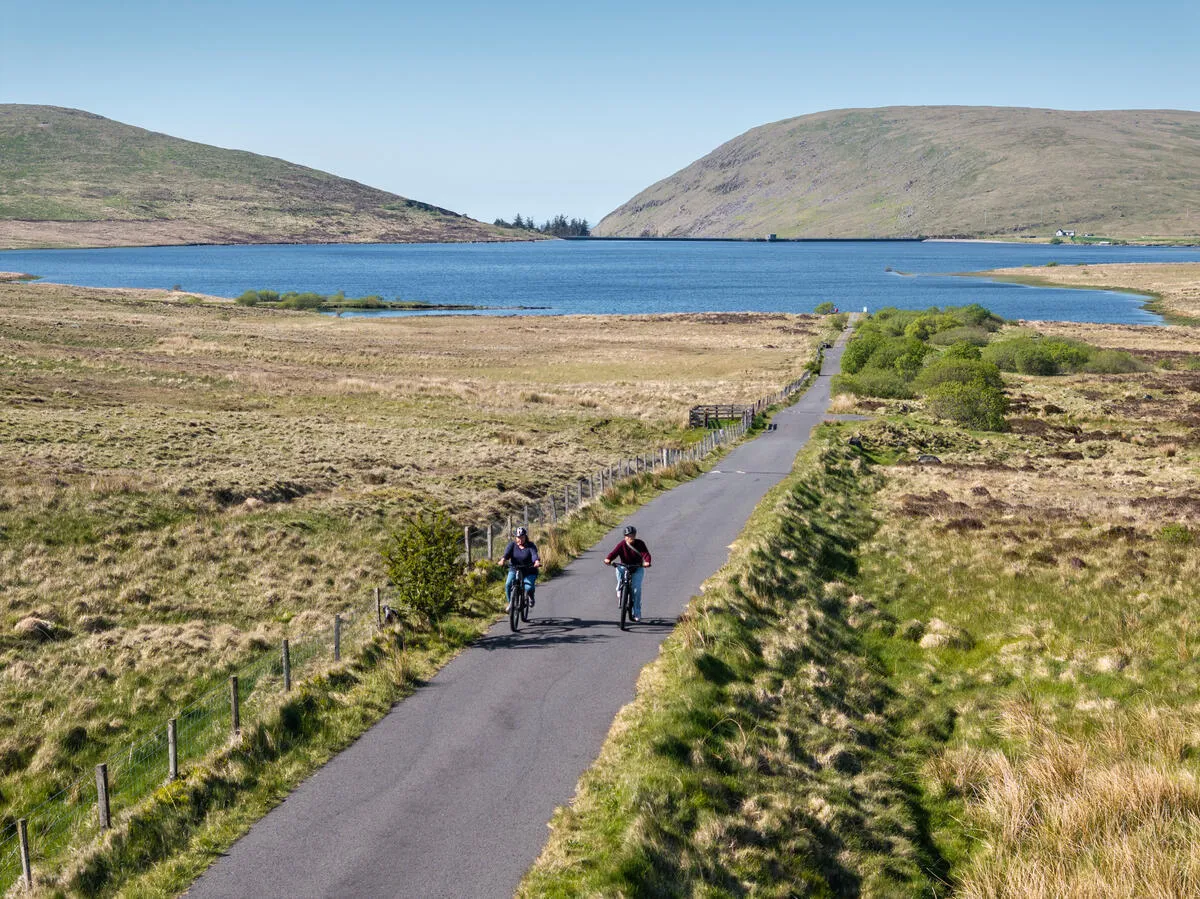
Introduction
The Mourne Mountains are an Area of Outstanding Natural Beauty (AONB) in County Down, and they come out of the Irish Sea in a hurry. There is very little flat ground between the coast road and the tops. That is the appeal, and it is also the problem. Most road cyclists come for the Mourne Loop (72 km/45 mi), which is built around the Spelga Dam climb. Mountain bikers head for the forest parks at Rostrevor and Castlewellan instead. Distances, elevation, logistics, safety notes and local services below are current for 2025.
1. The Flagship Road Ride: Mourne Loop
1.1 Overview
- Distance: 72 km (45 mi)
- Typical ride time: 3½–5 hours (average pace 20 km/h)
- Elevation gain: ~1 200 m (≈ 4 000 ft), the biggest climb is the Spelga Dam ascent (≈ 314 m/1 030 ft).
- Difficulty: Experienced cyclists, steady traffic on the A2 coastal road, several steep gradients, and a long descent into Newcastle.
- Start/finish: Newcastle town centre (promenade, cafés and bike-friendly amenities).
1.2 Route description (clockwise)
| Segment | Road / Trail | Key features | Approx. distance |
|---|---|---|---|
| Newcastle → Kilkeel | A2 coastal road | Sea views, Slieve Donard hotel, Royal County Down Golf Club | 15 km |
| Kilkeel → Greencastle | Minor roads through farmland | WWII runway remnants, open fields | 10 km |
| Greencastle → Rostrevor | A2 & local lanes | Carlingford ferry crossing (optional), historic houses | 12 km |
| Rostrevor → Spelga Dam | Quiet back-road through Kilbroney Forest | First major climb, forest scenery | 8 km |
| Spelga Dam → Bryansford | A25 winding climb (S-of-Spelga) | Switchbacks, moorland, wind exposure | 6 km |
| Bryansford → Tollymore | A25 descent past Tollymore Forest Park | Fast downhill, river bridges | 9 km |
| Tollymore → Newcastle | A2 coastal return | Final coastal stretch, panoramic mountain backdrop | 12 km |
1.3 The Spelga Dam Climb
- Length: 4.8 mi (7.7 km)
- Elevation gain: 1 030 ft (314 m)
- Average gradient: 4 % (steeper sections reach 8-10 % on the “S-of-Spelga” switchbacks)
- Surface: Well-maintained tarmac, but be prepared for occasional potholes after winter.
- Tips: Use a low gear for the tight switchbacks, keep a light front wheel for wind gusts, and enjoy the sweeping views over the reservoir and the surrounding peaks.
1.4 Where to refuel
| Location | Facilities | Recommended stop |
|---|---|---|
| Newcastle (start/end) | Numerous cafés, ice-cream parlours, bike-friendly pubs | Breakfast or post-ride coffee |
| Kilkeel | Small shops, fish & chips | Quick snack before the climb |
| Rostrevor | Café & Bistro, fresh bakery | Mid-ride refuel |
| Bryansford | Bike-friendly pub “The Barley Mow” | Hydration and energy bars |
2. Alternative Routes & Greenways
2.1 Mourne Coastal Route (Road)
- Length: 55 km (34 mi), a slightly shorter coastal loop that avoids the steep Spelga ascent.
- Highlights: Carlingford Lough, Murlough Nature Reserve, dramatic cliffs at St John’s Point.
- Ideal for: Riders seeking sea breezes and a flatter profile (≈ 800 m total gain).
2.2 Newry Canal Way (Traffic-free)
- Length: 23 km (14 mi) paved greenway from Newry to the historic Newry Canal.
- Surface: Smooth, compacted gravel, perfect for hybrids, touring bikes and families.
- Features: Canal-side wildlife, interpretive signage on industrial heritage, easy gradients.
2.3 Castle Ward & Strangford Greenway (Mixed)
- Length: 20 km (12 mi) loop around the shores of Strangford Lough, passing Castle Ward Demesne.
- Special: “Game of Thrones” themed waymarkers for fans; gentle undulations suitable for beginners.
2.4 Mountain-bike Forest Trails
| Trail | Location | Length | Difficulty | Notable |
|---|---|---|---|---|
| Castlewellan Loop | Castlewellan Forest Park | 18 km | Easy-moderate | Arboretum, lake views |
| Rostrevor Red Trail | Rostrevor Forest | 12 km | Hard (technical) | Rocky sections, fast descents |
| Kilbroney Forest Trails | Near Spelga Dam | 10 km | Mixed | Well-marked, good for skill practice |
3. Practical Planning
3.1 Getting There
| Mode | Details |
|---|---|
| By Car | M1 → A1 to Newry, then follow signs for Newcastle or Kilkeel. Parking is free at Newcastle promenade, Kilkeel round-about, and Bryansford car park (limited spaces). |
| By Train | NI Railways to Newcastle (approx. 30 min from Belfast). From the station, a short 10-minute ride on the Newcastle–Tollymore cycle path leads to the start of the loop. |
| By Bus | Ulsterbus routes 99 (Belfast–Newcastle) and 93 (Newry–Rostrevor). Buses stop near the A2, allowing easy bike-rack loading. |
3.2 Accommodation
| Type | Recommended | Price (per night) |
|---|---|---|
| B&B | The Old Station House (Newcastle), cosy rooms, bike-friendly storage | €80-€110 |
| Hostel | Rostrevor Youth Hostel, shared facilities, secure bike lock-up | €35-€45 |
| Self-catering | Mourne Mountain Retreat (near Spelga), fully equipped kitchen, parking | €120-€150 |
| Camping / Glamping | Cooley Glamping (Carlingford), yurts, shower blocks, electric bike hire onsite | €70-€95 |
3.3 Bike Hire & Services
- Bike Mourne (Rostrevor): road, mountain and e-bike fleet; delivery to your accommodation.
- Newcastle Bike Hire: 24-hour pick-up, helmets, lock-up, and repair kits.
- Cycling UK “Mourne Loop” GPX: downloadable route with waypoints, available from the Cycling UK website.
3.4 Gear Checklist
| Item | Why it matters |
|---|---|
| Helmet (mandatory) | Legal requirement and protection on mixed-traffic sections. |
| Tubeless tyres (30-32 mm) | Reduces puncture risk on gravel sections and improves grip on wet stone. |
| Layered clothing | Weather can swing from sunny to misty; a lightweight waterproof jacket is essential. |
| Hydration pack (≥ 1 L) | Few water points on the coastal stretch; refill at cafés. |
| Portable pump & spare tube | Potholes are common after winter storms. |
| Navigation, Garmin Edge 1030 or smartphone with Komoot offline maps. | |
| Sun protection, sunscreen, sunglasses, cap. |
3.5 Safety & Etiquette
- Traffic: The A2 carries moderate traffic; ride on the left, signal early, and keep a safe distance from larger vehicles.
- Weather: The Mournes can be windy, especially on the Spelga ascent. Check Met Éireann forecasts (use the “Mourne Mountains” alert).
- Wildlife: Red deer and mountain hares are common; give them space, especially at dawn/dusk.
- Leave No Trace: Pack out all litter, stay on marked paths, and respect private farmland signs.
- Emergency: The nearest ambulance station is in Newry (≈ 20 km). Carry a fully charged phone and the 112 emergency number.
4. Timing the Ride: Best Seasons
| Season | Pros | Cons |
|---|---|---|
| Late Spring (May-June) | Long daylight (up to 17 h), wildflowers, mild temperatures (12-18 °C). | Occasional showers; some farm gates may be closed. |
| Summer (July-August) | Warm weather, peak tourism, many cafés open. | Higher traffic on the A2, occasional heat (up to 25 °C). |
| Early Autumn (September-October) | Brilliant foliage, cooler rides (10-16 °C), fewer crowds. | Shorter daylight, increased chance of rain. |
| Winter (Nov-April) | Very quiet roads, dramatic misty landscapes. | Short daylight, icy patches, strong winds, only for experienced riders with proper gear. |
Recommendation: Late May to early October offers the optimal balance of weather, daylight and services.
5. Navigation Tools & Resources
| Tool | Platform | Key Features |
|---|---|---|
| Komoot | iOS / Android / Web | Turn-by-turn voice guidance, offline maps, community-rated highlights (cafés, viewpoints). |
| Strava Segment, Spelga Dam | Web / App | Real-time climb stats, leaderboards, segment analysis for pacing. |
| Ordnance Survey NI Explorer Map 12 | Paper / Digital | Detailed contour lines, footpaths, and rights-of-way information. |
| Cycling UK GPX | Download | Accurate route file with waypoints for water stops, emergency phones, and scenic pull-outs. |
| Met Éireann Weather App | iOS / Android | Hourly forecasts, rain radar, and mountain-specific alerts. |
6. Sample Itinerary: 2-Day Adventure
Day 1, Arrival & Coastal Loop
- Morning: Arrive in Newcastle, bike-hire or unpack.
- Ride the Mourne Coastal Route (55 km), enjoy sea views, stop at Kilkeel for lunch.
- Evening: Check-in at The Old Station House, dinner at a local seafood restaurant.
Day 2, Full Mourne Loop
- Early start (07:00) with a hearty breakfast.
- Follow the 72 km Mourne Loop, tackling Spelga Dam in the mid-morning.
- Mid-way snack in Rostrevor, then descend to Tollymore.
- Finish back in Newcastle; optional ice-cream at Nugelato.
- Late afternoon: Return bikes, depart or stay another night for a relaxed day of walking in Tollymore Forest Park.
7. Frequently Asked Questions
Q: Is the Mourne Loop suitable for a hybrid bike?
A: Yes, the route is fully tarmac, but the Spelga ascent can be demanding. A hybrid with a low gear ratio (compact chainset) will manage the climb comfortably.
Q: Can I ride the loop in winter?
A: It is possible for experienced cyclists who carry appropriate clothing, lights, and puncture-resistant tyres. Beware of ice on shaded sections and reduced daylight.
Q: Are dogs allowed on the routes?
A: Dogs are permitted on most public roads and greenways, provided they are on a leash and under control, especially on traffic-busy sections.
Q: Where can I find a reliable bike repair shop?
A: Newcastle Cycle Centre (12 Main Street, Newcastle) offers full service, spare parts and a 24-hour drop-off box for emergencies.
Conclusion
The Mournes fit a lot into a small area. From the 72 km Mourne Loop with its Spelga ascent, down to the flat compacted gravel of the Newry Canal Way, the range covers most abilities inside a fairly small map.
Two things decide whether the day goes well: the wind on Spelga, and the state of the tarmac after winter. Check the forecast, carry a spare tube and a pump, and start early enough that the A2 is still quiet when you come back along the coast.