Cycling the Dingle Peninsula: The Slea Head Drive
63 km around Slea Head in four sections, past coastal cliffs and early Christian sites. The weather turns quickly out here, so start early.
Introduction
The Slea Head Drive is a 63 km loop out of Dingle town, round the western tip of the peninsula and back. Three to four hours of actual pedalling for most people, with the climbing spread thinly across the day. Nothing on it is steep enough to put you off the bike.
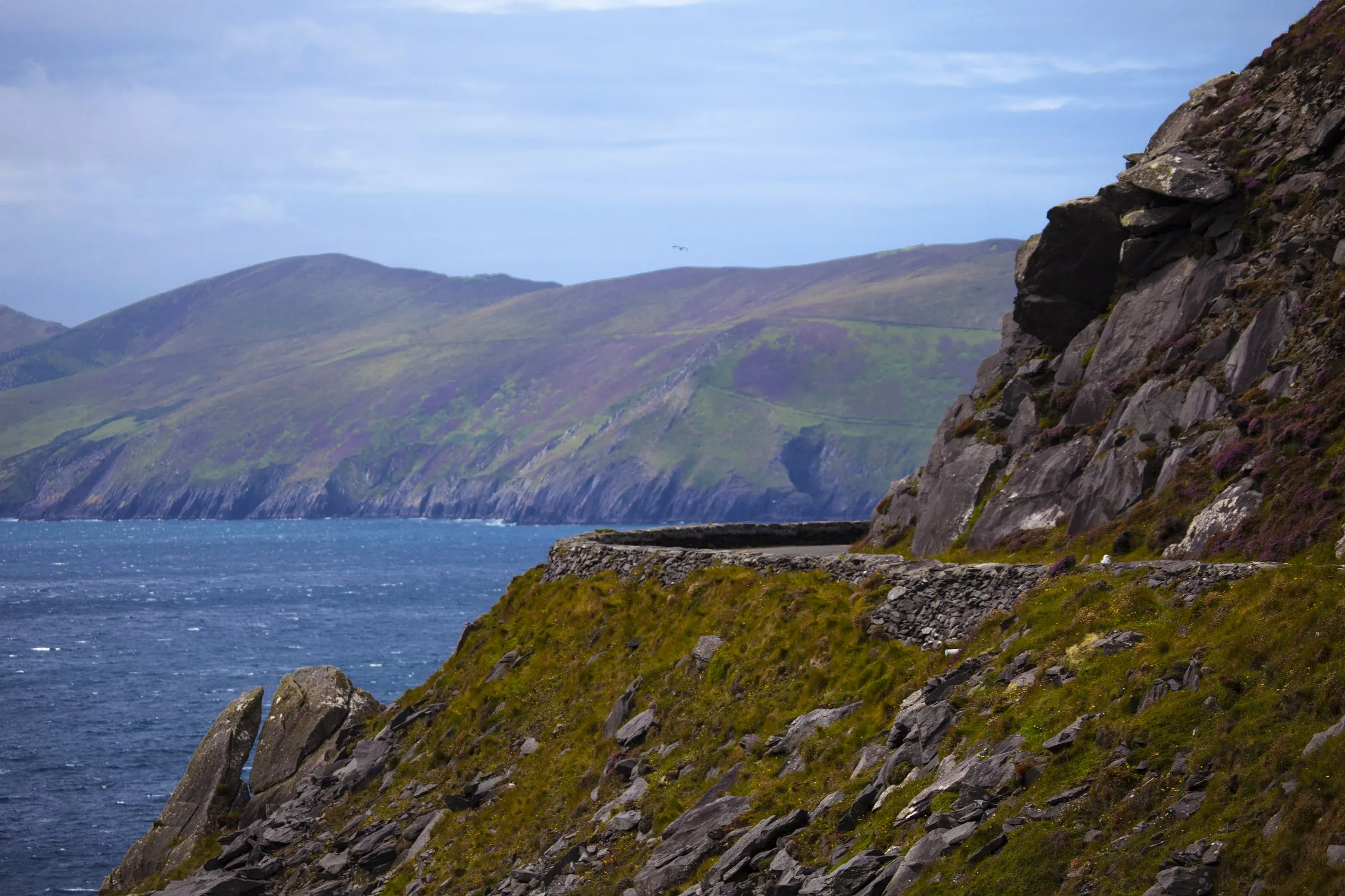
The wind is a different matter. Between Ventry and Dunquin there is almost no shelter, and a stiff westerly turns a flat road into work. Ride clockwise: the tour buses go the other way, and the narrow cliff-top section near the headland is no place to meet one coming at you. Pack a waterproof jacket whatever the forecast says.
1. Route Overview & Key Statistics
| Metric | Detail |
|---|---|
| Total distance | 63 km (≈ 39 mi) |
| Total ascent | 543 m (≈ 1 780 ft) |
| Highest point | 952 m (Mount Brandon), optional side-loop |
| Estimated ride time | 3–4 hours (average 15 km/h) |
| Surface | Mostly paved (tarmac) with occasional gravel sections near Ventry |
| Difficulty | Moderate, steady climbs, some narrow cliff-top sections |
| Best direction | Clockwise (to avoid on-coming tour buses) |
| Season | Late spring to early autumn; avoid high-wind winter days |
The loop starts and ends in Dingle, a lively harbour town with plenty of cafés, bike shops and accommodation options. From there you follow the coastal road northwards, passing Ventry, the Blasket Islands viewpoint, Slea Head, Dunquin, and returning via the inland road through Brandon Creek and Mount Brandon (optional).
Pro tip: The official Slea Head cycling itinerary on Let’s Cycle Ireland lists the route as a 55 km loop, but the full loop, including the inland return to Dingle, adds roughly 8 km, bringing the total to 63 km. Most cyclists include the extra stretch for a satisfying finish.
2. Detailed Section-by-Section Guide
2.1 Dingle → Ventry (≈ 12 km)
- Terrain: Gentle climb out of Dingle town, then a rolling descent toward the coast.
- Highlights:
- Dingle Oceanworld: a quick stop for a coffee or a glimpse of marine life.
- Ventry Beach: somewhere to get off the saddle for ten minutes.
- Tips: Early morning light is best for photos of the harbour; the road can be busy with tour buses later in the day.
2.2 Ventry → Slea Head (≈ 15 km)
- Terrain: Steady climb with a few short, sharp gradients (up to 6 %).
- Highlights:
- Gallarus Oratory: a 6th-century stone church perched on the cliffs.
- An Fear Marbh (The Dead Man): a sea stack that takes the light well late in the day.
- The Blasket Islands Viewpoint: on a clear day you can pick out the islands themselves.
- Safety: This section narrows considerably near the headland; stay centred and be prepared for occasional gusty winds.
2.3 Slea Head → Dunquin (≈ 9 km)
- Terrain: Mostly downhill, but the road twists tightly around the headland.
- Highlights:
- Slea Head Lighthouse: a great spot for a quick break; the lighthouse is still operational and offers sweeping sea views.
- Dunquin: a small village known for traditional Irish music, and Dunquin Pier, where you can watch the fishing boats come in.
- Tips: Watch out for cyclists travelling counter-clockwise; sticking to the clockwise direction reduces the chance of meeting on-coming tour buses.
2.4 Dunquin → Dingle (Inland Return, ≈ 27 km)
- Terrain: A steady climb up the Brandon Creek valley, then a gradual descent back to Dingle.
- Highlights:
- Mount Brandon (optional side-loop, 952 m), if you have extra time, a short detour to the summit rewards you with a 360° view of the Atlantic and the Skellig Islands.
- Anamur: a small, peaceful spot ideal for a snack or a refill of water.
- Dingle town: return to the lively streets, where you can celebrate with a pint at Dick Mack’s Pub, a favourite among cyclists.
- Tips: The inland road is less scenic but offers a welcome break from the coastal wind. It’s also the safest route for the final stretch into town.
3. Practical Information for Cyclists
3.1 Bike Hire & Gear
| Provider | Location | Types of Bikes | Approx. Daily Rate |
|---|---|---|---|
| Dingle Bike Hire | Main Street, Dingle | Road, hybrid, e-bike | €30-€45 |
| Cill Bhreac House | Near Ventry | Mountain & gravel | €25-€40 |
| Dingle Cycle Centre | Dingle Harbour | Road & touring | €35-€50 |
- Essential gear: waterproof pannier bag, spare inner tubes, a compact pump, and a fully charged power bank for navigation and photos.
- Helmet law: Ireland requires a helmet for cyclists under 18; it’s strongly recommended for all riders.
3.2 Navigation
- GPS: The Ride with GPS route (ID 32441205) offers turn-by-turn cues and elevation data.
- Maps: Offline maps from OSi Maps or Komoot are handy where mobile signal drops near the cliffs.
- Signage: The Slea Head loop is well-signed, but some junctions near Ventry can be confusing; keep your GPS handy.
3.3 Accommodation
| Type | Recommended Options | Approx. Price (per night) |
|---|---|---|
| B&B | The Dingle Skellig Hotel, The Atlantic House | €90-€130 |
| Hostel | Dingle Hostel (central, shared rooms) | €30-€45 |
| Self-catering | Cliffs of Moher Cottages (near Ventry) | €80-€120 |
| Camping | Dingle Bay Camping & Caravan Park | €25-€40 for a pitch |
Most places fill up quickly in July–August, so book at least 3 weeks in advance if you’re traveling in peak season.
3.4 Food & Drink Stops
- Dingle: Róisín’s Café for a hearty Irish breakfast; Jackie’s Café for fresh seafood.
- Ventry: The Village Café, great for a quick sandwich and a coffee.
- Dunquin: The Dunquin Bar, try the local Dingle Gold Ale and a plate of smoked salmon.
- Pack a lunch: A banana, energy bar, and a bottle of water will keep you fueled on the longer climbs.
3.5 Safety & Weather
- Wind: The Atlantic side can experience strong gusts, especially in March–May. Check Met Éireann forecasts before you set off.
- Rain: Irish weather changes quickly; a lightweight waterproof jacket and zip-off leg warmers are essential.
- Road traffic: Tour buses frequent the coastal road during summer. Riding clockwise and keeping to the right lane reduces conflict.
- Emergency services: The nearest Garda station is in Dingle (phone +353 79 915 5000). Carry a basic first-aid kit and a spare tyre.
4. Extending the Adventure
4.1 The Dingle Way
If you have an extra day, the Dingle Way (130 km) runs parallel to much of the Slea Head loop and offers a mix of walking and cycling sections. You can link the two routes for a two-day “Dingle Peninsula Loop”, staying overnight in Ventry or Ballyferriter.
4.2 Mount Brandon Pilgrimage
For the more adventurous, a side-trip up Mount Brandon (952 m) adds a challenging climb and a spiritual element, the mountain is linked to the legend of St Brendan the Navigator, who allegedly set sail from here to discover America in 520 AD.
4.3 Boat Trips to the Blasket Islands
From Dunquin you can catch a short boat ride (≈ 15 min) to the Great Blasket Island. The island is uninhabited but offers a dramatic backdrop for photos and a chance to explore the ruins of an old lighthouse.
5. Suggested Itinerary (One-Day Loop)
| Time | Activity | Notes |
|---|---|---|
| 08:00 | Pick up bike in Dingle, quick breakfast at Roisín’s | Fuel up early, the first climb is gentle. |
| 08:30 | Depart Dingle → Ventry | Enjoy coastal views; stop for a photo at Ventry Beach. |
| 09:30 | Ventry → Slea Head | Climb to Gallarus Oratory; take a short break. |
| 10:30 | Slea Head Lighthouse → Dunquin | Snap the sea stack An Fear Marbh. |
| 11:30 | Lunch in Dunquin (pub or packed) | Re-hydrate and refuel. |
| 12:30 | Dunquin → Dingle (inland) | Steady climb; optional detour to Mount Brandon if time allows. |
| 14:30 | Arrive back in Dingle | Celebrate with a pint at Dick Mack’s or a late lunch. |
Total riding time ≈ 3 hours, leaving ample room for photo stops, a beach walk, or a quick boat trip.
Conclusion
The surface is good tarmac nearly the whole way, and both ends of the day are spent in a town with a bike shop in it. What makes Slea Head hard is exposure, not gradient. At a distance of 63 km it fits comfortably into a day, with time left over for the pier at Dunquin or a boat across to the Blaskets.
Book your bed early if you are coming in July or August. Check Met Éireann the night before and again over breakfast, because forecasts on this coast rarely survive the night. Then ride clockwise.