
The Valentia Island Cycling Loop: 53 km on the Skellig Coast
53 km around Valentia, taking in Bray Head, the tetrapod trackway and the Skellig Experience. Arrive by ferry or bridge, and allow a full day.
Introduction
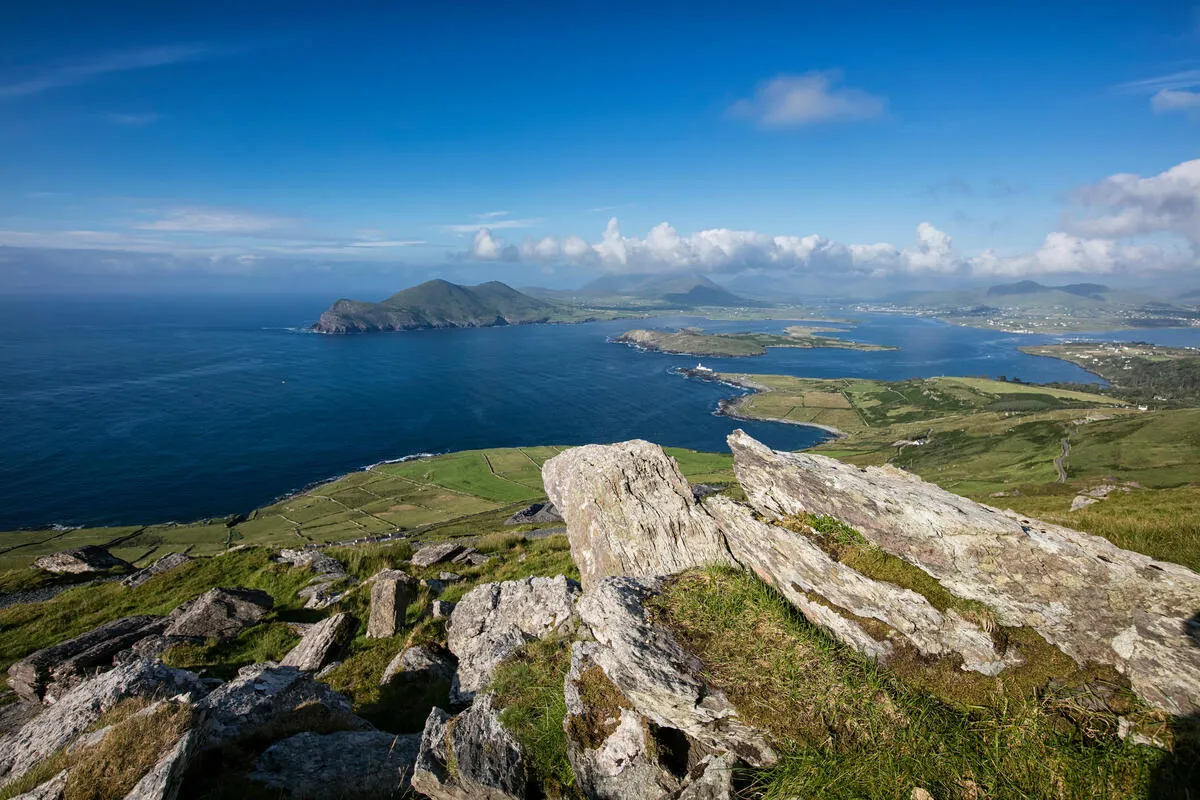
Reached either by ferry or by bridge, Valentia Island is one of Ireland’s most westerly points, sitting off the Iveragh Peninsula at the end of the Skellig Coast. The island’s 53 km (33 mi) loop takes in cliffs, a lighthouse and a fossil trackway laid down 385 million years ago, and it fits comfortably into a day. Road bikes, gravel bikes and hybrids all cope with it. The two things worth sorting before you go are the ferry timetable and what you will wear when the wind gets up. It will.
Getting There: Ferry, Bridge and Parking
| Transport | Details |
|---|---|
| Valentia Island Car Ferry | Operates 7:45 am, 9:30 pm daily throughout the summer (May, September). The crossing from Knightstown (Cahersiveen) to Valentia Harbour takes about 10 minutes and runs every 30 minutes at peak times. |
| Bridge at Portmagee | A permanent bridge links the mainland at Portmagee to the island’s northern tip. No schedule to worry about, but the bridge can be busy in summer, especially on weekends. |
| Parking | Small car parks exist at the ferry terminals (both sides) and at the Glanleam House car park. Arrive early in high season to secure a space. |
Tip: If you’re travelling by bike, the ferry accepts bicycles free of charge on the car-deck. Bring a waterproof bike cover for the short sea crossing, the wind can be brisk even on sunny days.
The Loop Overview: Distance, Elevation and Surface
| Metric | Value |
|---|---|
| Total distance | 53 km (33 mi) |
| Total ascent | 550 m (1 800 ft) |
| Highest point | 151 m (≈ 500 ft) at Bray Head |
| Surface | Predominantly paved (tarmac and smooth concrete) with short gravel sections near the Tetrapod Trackway and Glanleam Beach. |
| Difficulty | Moderate, good fitness required; suitable for most road-bike riders and hybrid cyclists. |
The loop can be ridden clockwise (starting at the ferry terminal) or anticlockwise; many riders prefer a clockwise direction to enjoy the early-morning sunrise over the Atlantic at Bray Head and finish with a sunset view from Portmagee Harbour.
Elevation Profile at a Glance
- Start, Knightstown Ferry Terminal: Sea-level, gentle roll-out onto the R564.
- Glanleam House & Gardens (km 5): Slight climb to the house (≈ 30 m).
- The Grotto & Lighthouse (km 12-14): Steepest section, climbing to Bray Head (151 m), the loop’s high point.
- Tetrapod Trackway (km 22-24): Short gravel stretch, modest descent.
- Portmagee Harbour (km 38): Flat, scenic coastal ride back to the bridge.
The climbing is spread out rather than concentrated. There is no single brutal hill, which puts the route within reach of anyone with reasonable fitness.
Highlights Along the Route
1. Valentia Island Heritage Centre
Located near the ferry terminal, this small museum showcases the island’s maritime history, the famous Mizen Head Signal Station photographs and the Skellig Experience interpretive displays. A quick stop adds cultural context to your ride.
2. Glanleam House & Gardens
The 19th-century manor has a café and well-kept gardens, and there is a water tap here if you need to refill. Glanleam Beach lies just beyond, a short detour if you fancy a dip (weather permitting).
3. The Grotto & Valentia Lighthouse
Perched on a dramatic headland, the grotto is a natural sea-cave with a small pool at low tide. The lighthouse, built in 1864, offers panoramic views of the Atlantic and the distant Skellig Islands. Photographers love the interplay of light and rock here.
4. Bray Head and the Tetrapod Trackway
Bray Head’s cliffs give the widest ocean views on the loop. Nearby is the Tetrapod Trackway, a fossilised 385-million-year-old marine footprint. The trackway is partially unpaved; a sturdy tyre or gravel-bike performs best.
5. Skellig Experience Interpretive Centre
A short walk from the loop’s northern end, this centre tells the story of the Skellig Islands, their monastic settlement and the modern film heritage (Star Wars). It’s a great spot to stretch your legs and learn about the UNESCO World Heritage Site.
6. Portmagee Harbour
The loop finishes at the harbour. Refuel at The Harbour Café, which does a lamb and vegetable Skellig Pie, or arrange a boat tour out to the Skelligs. The fishing fleet works out of here, so it is rarely quiet.
Practical Tips for a Smooth Ride
Bike Choice
- Road bike with wide-range gearing works well on the mostly paved route.
- Gravel bike offers extra comfort on the short unpaved sections near the Tetrapod Trackway.
- Hybrid/fitness bike is also suitable for riders who prefer a more upright position.
Navigation
- Komoot, Strava or Ride with GPS have pre-loaded routes (e.g., “Valentia Island loop from Cahersiveen”) with turn-by-turn cues.
- Download the ActiveME iPhone/Android app for offline maps, it includes the exact distance (53 km) and elevation data.
Weather & Clothing
- The Skellig Coast is exposed; wind can be strong even on calm days. Pack a wind-proof jacket, layered clothing, and water-proof shoe covers.
- Summer (June-August) averages 15-18 °C, but mornings can be cool (10 °C). Autumn remains rideable, though daylight shortens after 5 pm.
Safety
- Helmet mandatory for all cyclists in Ireland.
- Carry a spare tube, pump and multi-tool, the few gravel sections can cause punctures.
- Mobile signal is generally good near Portmagee and the ferry terminals but can be patchy on the western cliffs; consider a GPS messenger for emergencies.
Timing the Loop
- Full loop: Allocate 3–4 hours (including stops). Start early (8 am) to beat the mid-day crowds at the ferry.
- Half-loop options: If pressed for time, ride the Cahersiveen → Portmagee segment (≈ 20 km) and return by ferry, or explore the Bray Head → Glanleam section as a scenic out-and-back.
Suggested Itinerary: One-Day Adventure
| Time | Activity |
|---|---|
| 07:45 | Arrive at Cahersiveen Ferry Terminal, park, and board the ferry (bike on board). |
| 08:15 | Disembark at Valentia Harbour, brief coffee at the Heritage Centre Café. |
| 08:45 | Begin the loop clockwise, heading towards Glanleam House (first 5 km). |
| 09:30 | Explore Glanleam Gardens and optional beach run. |
| 10:15 | Ride to the Grotto & Lighthouse, enjoy panoramic photos. |
| 11:00 | Climb to Bray Head, stop at the Tetrapod Trackway for a short walk. |
| 12:00 | Lunch break at Portmagee Harbour, fresh fish and chips. |
| 13:00 | Visit the Skellig Experience Centre; optional boat tour (weather permitting). |
| 14:30 | Continue the loop back to Cahersiveen, taking in the coastal views. |
| 15:30 | Catch the ferry back to the mainland, or park and explore Cahersiveen town. |
Adjust times based on fitness level, weather and how long you linger at each attraction.
Accommodation & Food Options
| Location | Type | Highlights |
|---|---|---|
| Valentia Island Guesthouse (near the ferry) | B&B | Cozy rooms, homemade Irish breakfast, close to the loop start. |
| Portmagee Harbour Hotel | Hotel | Sea-view rooms, on-site restaurant serving locally sourced seafood. |
| South Kerry Cycles (Valentia Island) | Bike hire & café | Offers mountain-bike rentals, repair services, and light snacks. |
| The Harbour Café (Portmagee) | Café/Restaurant | Known for its Skellig Pie (a hearty lamb & vegetable pie). |
Booking ahead during July and August is advisable, as the island’s limited accommodation fills quickly.
Environmental Considerations
- Stay on marked roads and paths: the island’s fragile cliffs and dunes are home to rare seabirds (e.g., Manx shearwater).
- Carry out all litter: there are few bins on the loop.
- Respect wildlife: especially during nesting season (April-July) near the lighthouse and cliffs.
- Use reusable water bottles: refill at cafés or the Glanleam House water tap.
None of that is onerous. Mostly it comes down to staying on the road and taking your rubbish home with you.
Conclusion
Valentia is a small island with a lot packed into it, and the loop gets round most of it. At 53 km with the climbing spread evenly, it is a day out rather than a test, and most riders will manage it. Check the ferry times, take a windproof, and allow longer than the distance suggests. You will keep stopping.