Five Photo Stops on the Wild Atlantic Way
Malin Head, Slieve League, Keem Bay and two more, with the cycling logistics for reaching each and the light that suits them best.
Introduction
The Wild Atlantic Way (WAW) stretches over 2 500 km of coastline, threading fifteen counties from Donegal in the north to Cork in the south. The weather on it is notoriously changeable. That is bad for schedules and often good for photographs, since cloud does more for a cliff face than clear blue does.
The five stops below run from Malin Head in Donegal down to the Cliffs of Moher in Clare. Each one gives the nearest town, the surface, the climbing, and the hour of the day worth waiting for.
1. Malin Head: The Tip of Ireland (County Donegal)
Why it shines on Instagram
- Panoramic cliffs dropping into the Atlantic, with Ballymastocker Lighthouse framing the horizon.
- Northern lights (Aurora Borealis) are occasionally visible from this latitude, adding an ethereal glow to night-time shots.
Cycling route & logistics
| Detail | Info |
|---|---|
| Nearest town | Dunfanaghy (12 km north) |
| Typical ride | Dunfanaghy → Malin Head, 12 km each way, mostly tarmac with short gravel sections on the final approach. |
| Elevation gain | Approx. 150 m, gentle climb, suitable for most road bikes. |
| Bike parking | Free roadside bays at the Malin Head Visitor Centre (capacity for 15 bikes). |
| Amenities | Café & toilet at the centre; refill water points in Dunfanaghy. |
Photo tip
Arrive 30 minutes before sunrise (early March-April) to capture the golden light washing over the cliffs. A wide-angle lens (16-35 mm) works best for the expansive seascape, while a telephoto (70-200 mm) can isolate the lighthouse against the sky.
2. Slieve League Cliffs: Ireland’s Hidden Giant (County Donegal)
Why it shines on Instagram
- Towering 600 m sheer cliffs, often less crowded than the Cliffs of Moher.
- Dramatic cloud formations and sea spray create high-contrast, moody images.
Cycling route & logistics
| Detail | Info |
|---|---|
| Nearest town | Glenveagh (via R263) |
| Typical ride | Glenveagh → Slieve League, 15 km round-trip, asphalt with a short gravel section near the viewpoint. |
| Elevation gain | 200 m, steady climb, moderate difficulty. |
| Bike parking | Small gravel lot at the Slieve League Viewpoint (pay-and-display). |
| Amenities | Picnic tables; no permanent café, carry a snack and water. |
Photo tip
Visit mid-day in late summer when the sun is high, casting dramatic shadows on the cliff face. A polarising filter will cut glare and enhance the blue of the Atlantic. For a unique perspective, bring a compact drone (check local regulations, no-fly zones apply within 500 m of the viewpoint).
3. Keem Bay, Achill Island: Turquoise Waters & Golden Sands (County Mayo)
Why it shines on Instagram
- A sheltered crescent of white sand backed by dramatic cliffs; the water’s turquoise hue is unrivalled on the west coast.
- The old stone lighthouse on the headland adds a historic touch.
Cycling route & logistics
| Detail | Info |
|---|---|
| Nearest town | Achill Sound (via R319) |
| Typical ride | Achill Sound → Keem Bay, 22 km each way, paved with occasional cobbled sections near the village. |
| Elevation gain | 180 m, gentle rolling hills, suitable for road and hybrid bikes. |
| Bike parking | Dedicated racks at the Keem Bay car park (free, 20-bike capacity). |
| Amenities | Small café at Keel (5 km away); water refill at the Achill Visitor Centre. |
Photo tip
The golden hour just before sunset paints the sand in warm tones. Position yourself on the upper cliff path for a sweeping view of the bay, using a neutral density filter to balance the bright sky and darker foreground.
4. Dingle Peninsula: Slea Head Loop (County Kerry)
Why it shines on Instagram
- Slea Head Drive runs past rugged headlands, ancient beehive huts, and the Mount Brandon silhouette.
- Dunmore Head gives you a sea-stack backdrop that suits long exposures.
Cycling route & logistics
| Detail | Info |
|---|---|
| Nearest town | Dingle (base for most riders) |
| Typical ride | Dingle → Slea Head Loop, 55 km circular, tarmac with well-maintained shoulders. |
| Elevation gain | 650 m total, challenging but rewarding; many riders opt for a mixed-gear bike. |
| Bike parking | Secure racks in Dingle town centre (free, 30-bike capacity). |
| Amenities | Numerous cafés, pubs, and water refill stations along the loop; bike-repair shop in Dingle. |
Photo tip
Start the loop early morning (around 6 am) to capture the first light on Slea Head. A fast prime lens (35 mm f/1.4) will let you shoot in low light without raising ISO too much, preserving detail in the clouds.
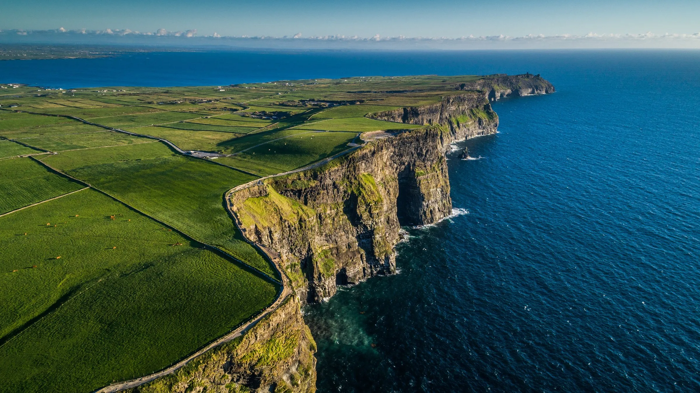
5. The Cliffs of Moher (County Clare)
Why it shines on Instagram
- World-renowned cliffs rising 214 m above the Atlantic, with the Aran Islands visible on clear days.
- The visitor centre’s glass-floor boardwalk offers a daring perspective for daring photographers.
Cycling route & logistics
| Detail | Info |
|---|---|
| Nearest town | Doolin (gateway village) |
| Typical ride | Doolin → Cliffs of Moher, 8 km each way, tarmac; the road is traffic-calmed during peak season. |
| Elevation gain | 80 m, gentle climb, perfect for all bike types. |
| Bike parking | Paid bike-only lot at the Cliffs Visitor Centre (15 min free, then €2/hr). |
| Amenities | Café, restrooms, and a water refill point at the centre; bike-repair kiosk in Doolin. |
Photo tip
Avoid the midday crowds by arriving before 7 am or after 7 pm in summer. Use a telephoto lens (70-300 mm) to compress the cliffs and capture the sweeping sea-level horizon. For a dramatic night-shot, the cliffs are illuminated during the full-moon phase, bring a sturdy tripod.
Practical Cycling Tips for the Wild Atlantic Way
- Plan for weather: Irish coastal weather is notoriously changeable. Pack a water-proof jacket, spare tube, and multi-tool. Cloudy skies can actually enhance mood in landscape photos.
- Stay fueled: Most villages have cafés but distances can be long. Carry energy bars and a portable water bladder (minimum 1 L capacity).
- Navigation: A offline GPS app (e.g., Komoot or Ride with GPS) with pre-loaded WAW routes ensures you stay on the right roads even when mobile signal drops.
- Safety first: Wear a high-visibility jacket and helmet; many sections have narrow shoulders. Signal early when overtaking cyclists or cars.
- Respect local rules: Some photo spots (e.g., Skellig Michael) require pre-booking and restrict drone usage. Always check the National Parks & Wildlife Service guidelines.
Conclusion
None of these five needs a long detour off the main route. Doolin and Dingle have bike repair on hand and the others do not, so schedule anything involving tools around those two. Slieve League has no café at all; carry your own food.
The rest is light and weather, and neither is under your control. Take the polarising filter, take the waterproof, and don’t write off a grey morning. Share your best shots on cyclingholidays.ie when you get home.